Wallops Flight Facility Airport (WAL / KWAL) — Wallops Island, VA
Wallops Flight Facility Airport (WAL)
WAL
Wallops Flight Facility Airport (WAL)
Wallops Island, VA
Latest photos of Wallops Flight Facility Airport (WAL)
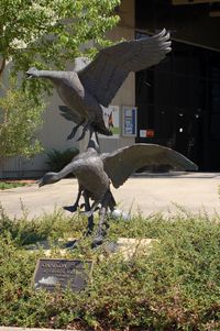
scotch-canadian
scotch-canadian
scotch-canadian
Wallops Flight Facility Airport (WAL/KWAL) is a private-use airport located in Wallops Island, VA. The airport sits at an elevation of 40 feet above mean sea level. It features 3 runways. Aviation communications are supported by 11 published radio frequencies. The gallery includes 3 photos of operations and aircraft at the airport.
| FAA Information Effective | 2026-09-03 |
| Airport Identifier | WAL |
| Airport Status | Operational |
| Longitude/Latitude |
75°27'59.0000"
W /
37°56'24.7000"
N -75.466389 / 37.940194 (Estimated) |
| Elevation | 40.20 ft / 12.25 m (Surveyed) |
| Land | 617 acres |
| From nearest city | 5 nautical miles S of Wallops Island, VA |
| Location | Accomack County, VA |
| Magnetic Variation | 11W (2015) |
| Airport Use | Private |
| Wind indicator | Yes |
| Segmented Circle | No |
| Control Tower | ATCT |
| Beacon Color | White-Green (lighted land airport) |
| Landing fee charge | No |
| Sectional chart | WASHINGTON |
| Region | AEA - Eastern |
| Responsible ARTCC | ZDC - WASHINGTON |
| Tie-in FSS | DCA - LEESBURG |
| FSS on Airport | No |
| FSS Toll Free | 1-800-WX-BRIEF |
| NOTAMs Facility | WAL (NOTAM-d service available) |
Runway 04/22
| Dimensions | 8748 x 150 ft (2666 x 46 m) |
| Surface | ASPH-CONC (GOOD) |
| Surface treatment | |
| Edge lights | High |
| 04 | 22 | |
|---|---|---|
| Alignment | 32° | 212° |
| Physical elevation | 34.00 ft | 31.30 ft |
| Coordinates | 37.927070 / -75.470947 | 37.947400 / -75.454786 |
| Traffic pattern | Left | Left |
| Runway marking | Non-precision instrument , Good Condition | Non-precision instrument , Good Condition |
| VGSI | 4-light PAPI on left | 4-light PAPI on left |
| Runway end lights | Yes | Yes |
Runway 10/28
| Dimensions | 8005 x 200 ft (2440 x 61 m) |
| Surface | ASPH-CONC (GOOD) |
| Surface treatment | |
| Edge lights | High |
| 10 | 28 | |
|---|---|---|
| Alignment | 90° | 270° |
| Physical elevation | 19.40 ft | 35.20 ft |
| Coordinates | 37.942935 / -75.485075 | 37.942798 / -75.457316 |
| Traffic pattern | Left | Left |
| Runway marking | Non-precision instrument , Good Condition | Non-precision instrument , Good Condition |
| VGSI | 4-light PAPI on left | 4-light PAPI on left |
| Runway end lights | Yes | Yes |
Runway 17/35
| Dimensions | 4808 x 150 ft (1465 x 46 m) |
| Surface | ASPH (GOOD) |
| Surface treatment | |
| Edge lights | High |
| 17 | 35 | |
|---|---|---|
| Alignment | 158° | 338° |
| Physical elevation | 30.70 ft | 34.60 ft |
| Coordinates | 37.947180 / -75.467927 | 37.934963 / -75.461604 |
| Traffic pattern | Left | Left |
| Runway marking | Non-precision instrument , Fair Condition | Non-precision instrument , Fair Condition |
| VGSI | 4-light PAPI on left | 4-light PAPI on left |
| Runway end lights | Yes | Yes |
- EXTENSIVE RESEARCH TEST DEVELOPMENT IN PROGRESS.
- MILITARY TURBOPROP TRAINING DAILY UNTIL 2300L.
- FCLP EQUIPMENT DIRECTLY ADJACENT TO LEFT SIDE OF RWY 10 1335-1725 FT FM APPROACH END. FCLP EQUIPMENT DIRECTLY ADJACENT TO LEFT SIDE OF RWY 28 1340-1725 FT FM APPROACH END.
- TOUCH AND GO LDGS NA WHEN ATCT CLSD.
- RWY 17/35 CLSD WHEN ATCT CLSD.
- WHEN ATCT CLSD, 126.5 CTAF ONLY. EXPC NO RESP OR ADZY SVCS.
- E-28 ARRESTING GEAR 1500 FT FM THE NORTH END OF RWY 22 IS RIGGED/IN BATTERY.
- PPR 24 HR PN TO LDG, PHONE 757-824-1688.
- FOR CD CTC PATUXENT APCH AT 301-342-3740, WHEN PATUXENT APCH IS CLSD CTC POTOMAC APCH AT 866-640-4124.
- DEER & BIRDS ON AND INVOF ARPT.
- NUMEROUS RADAR FACILITIES AT ARPT WITH POSSIBLE RADIO FREQUENCY HAZARD TO ORDNANCE.
- EXISTED PRIOR TO 1959.