Santa Paula Airport Photo
Photo ID: AP2391
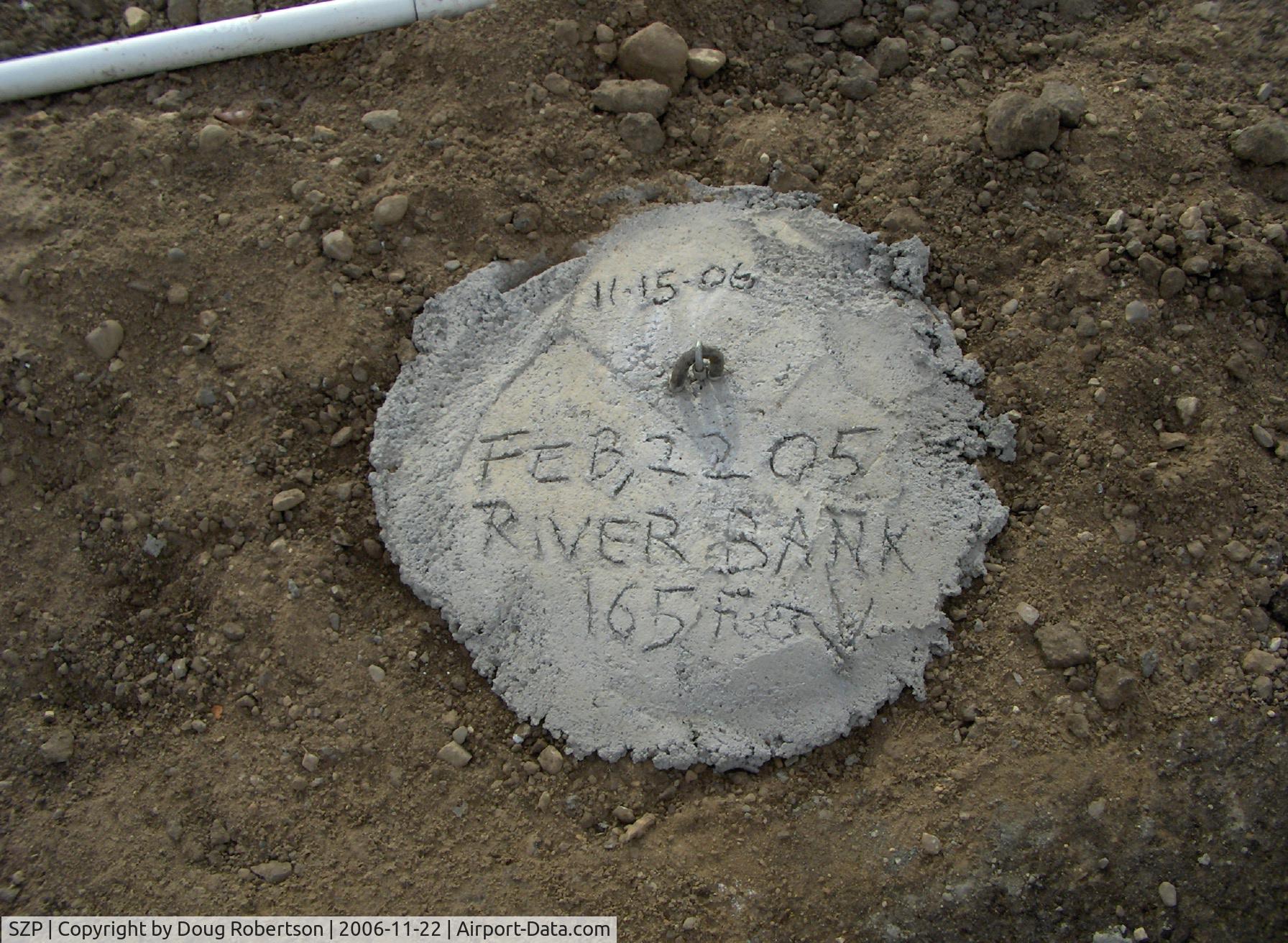
New aircraft tail anchor pad set in concrete-Commemorating 2005-02-22 Santa Clara River washed out part of Rwy 04-22 disabling Airport for 5+ months. River overflow washed out land to 165 feet from this point
Photo Info
| Airport | Santa Paula Airport |
|---|---|
| Photographer |
Doug Robertson
Contact
|
| Shot Date | 2006-11-22 |
| Upload Date | 2006-11-27 |
| Views | 1,142 |
EXIF Data
| Camera Make | Hewlett-Packard |
|---|---|
| Camera Model | HP PhotoSmart R607 (V01.00) |
| Shutter Speed | 1/521 sec |
| Aperture | f/4.3 |
| ISO | 100 |
| Focal Length | 5.8 mm |
| Exposure Bias | 0 EV |
| Metering Mode | Center-weighted average |
| White Balance | Auto |
| Dimensions | 1792 × 1312 |
| Date Taken | 2006-11-22 10:45:51 |
More photos of Santa Paula Airport
Total 1165 photos.
View all photos

Doug Robertson

Doug Robertson

Doug Robertson

Doug Robertson
 - by Doug Robertson")
Doug Robertson