Santa Paula Airport Photo
Photo ID: AP24343

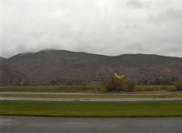
T-REX radio-controlled helicopter with control/transmitter unit and remote pilot. (you learn to fly/control this helicopter on a PC simulator program, and control unit records cumulative hours of flight, etc)
Photo Info
| Airport | Santa Paula Airport |
|---|---|
| Photographer |
Doug Robertson
Contact
|
| Shot Date | 2006-05-07 |
| Upload Date | 2011-11-04 |
| Views | 677 |
EXIF Data
| Camera Make | Hewlett-Packard |
|---|---|
| Camera Model | HP PhotoSmart R607 (V01.00)d |
| Shutter Speed | 1/253 sec |
| Aperture | f/4.3 |
| ISO | 100 |
| Focal Length | 5.8 mm |
| Exposure Bias | 0 EV |
| Metering Mode | Center-weighted average |
| White Balance | Auto |
| Dimensions | 1792 × 1312 |
| Date Taken | 2006-05-07 11:43:19 |
More photos of Santa Paula Airport
Total 1165 photos.
View all photos

Doug Robertson
Doug Robertson
COOL LAST SAMURAI
Doug Robertson
Doug Robertson