May River Airstrip, May River, Papua New Guinea (AYRV / MRH)
May River Airstrip
AYRV/MRH
May River Airstrip
May River, Papua New Guinea
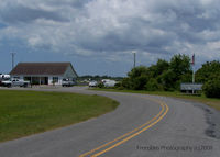
Latest photo of May River Airstrip, May River, Papua New Guinea
J.B. Barbour
May River Airstrip (AYRV/MRH) is a small airfield located in May River, Papua New Guinea. The airfield is situated at an elevation of 107 feet (33 meters) above sea level. Operations are conducted on 1 runway. The gallery features 1 photo documenting air traffic and facilities at the airport.
Runway 05/23
| Dimensions | 1,969 x 98 ft (600 x 30 m) |
| Surface | Grassed brown clay |
| Lighted | No |
| Status | Open |
| 05 | 23 | |
| Heading (True) | ° | ° |
| Latitude |
0.000000 N 0° 00' 00.00" |
0.000000 N 0° 00' 00.00" |
| Longitude |
0.000000 E 0° 00' 00.00" |
0.000000 E 0° 00' 00.00" |
| Elevation | 0 ft | 0 ft |
| Displaced Threshold | 0 ft | 0 ft |