Mohamed Boudiaf International Airport, Constantine, Algeria (DABC / CZL)
Mohamed Boudiaf International Airport
DABC/CZL
Mohamed Boudiaf International Airport
Constantine, Algeria
Latest photos of Mohamed Boudiaf International Airport, Constantine, Algeria
Bob Simmermon
Bob Simmermon
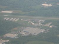
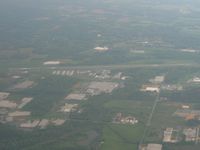
Mohamed Boudiaf International Airport (DABC/CZL) is a major international airport located in Constantine, Algeria. The airfield is situated at an elevation of 2265 feet (690 meters) above sea level. Operations are conducted on 2 runways. The facility operates 2 published communication frequencies. The gallery features 2 photos documenting air traffic and facilities at the airport.
Runway 13/31
| Dimensions | 7,874 x 148 ft (2400 x 45 m) |
| Surface | Asphalt |
| Lighted | Yes |
| Status | Open |
| 13 | 31 | |
| Heading (True) | 136° | 316° |
| Latitude |
36.284401 N 36° 17' 03.84" |
36.268902 N 36° 16' 08.05" |
| Longitude |
6.614720 E 6° 36' 52.99" |
6.633330 E 6° 37' 59.99" |
| Elevation | 2306 ft | 2254 ft |
| Displaced Threshold | 0 ft | 0 ft |
Runway 16/34
| Dimensions | 9,843 x 148 ft (3000 x 45 m) |
| Surface | Asphalt |
| Lighted | No |
| Status | Open |
| 16 | 34 | |
| Heading (True) | 159° | 339° |
| Latitude |
36.288101 N 36° 17' 17.16" |
36.262798 N 36° 15' 46.07" |
| Longitude |
6.610560 E 6° 36' 38.02" |
6.622500 E 6° 37' 21.00" |
| Elevation | 2313 ft | 2316 ft |
| Displaced Threshold | 0 ft | 0 ft |