Tern Hill Airfield, Market Drayton, Shropshire, United Kingdom (EGOE)
Tern Hill Airfield
EGOE
Tern Hill Airfield
Market Drayton, Shropshire, United Kingdom
Latest photos of Tern Hill Airfield, Market Drayton, Shropshire, United Kingdom
ChrisHall
Chris Hall
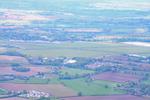
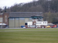
Tern Hill Airfield (EGOE) is a small airfield located in Market Drayton, Shropshire, United Kingdom. The airfield is situated at an elevation of 272 feet (83 meters) above sea level. Operations are conducted on 2 runways. The facility operates 3 published communication frequencies. The gallery features 2 photos documenting air traffic and facilities at the airport.
Runway 05/23
| Dimensions | 3,215 x 150 ft (980 x 46 m) |
| Surface | Asphalt |
| Lighted | Yes |
| Status | Open |
| 05 | 23 | |
| Heading (True) | 43° | 223° |
| Latitude |
52.870701 N 52° 52' 14.52" |
52.876900 N 52° 52' 36.84" |
| Longitude |
-2.536030 W 2° 32' 09.71" |
-2.526560 W 2° 31' 35.62" |
| Elevation | 265 ft | 272 ft |
| Displaced Threshold | 0 ft | 620 ft |
Runway 10/28
| Dimensions | 3,110 x 150 ft (948 x 46 m) |
| Surface | Asphalt |
| Lighted | Yes |
| Status | Open |
| 10 | 28 | |
| Heading (True) | 99° | 279° |
| Latitude |
52.873501 N 52° 52' 24.60" |
52.872299 N 52° 52' 20.28" |
| Longitude |
-2.540170 W 2° 32' 24.61" |
-2.526820 W 2° 31' 36.55" |
| Elevation | 264 ft | 268 ft |
| Displaced Threshold | 0 ft | 630 ft |