RAF Linton-on-Ouse, York, North Yorkshire, United Kingdom (EGXU / HRT)
RAF Linton-on-Ouse
EGXU/HRT
RAF Linton-on-Ouse
York, North Yorkshire, United Kingdom
Latest photos of RAF Linton-on-Ouse, York, North Yorkshire, United Kingdom

Steve Raper

Steve Raper
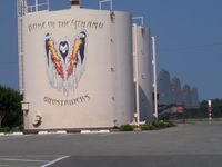
rupert2829

rupert2829
RAF Linton-on-Ouse (EGXU/HRT) is a closed airfield located in York, North Yorkshire, United Kingdom. The airfield is situated at an elevation of 53 feet (16 meters) above sea level. Operations are conducted on 2 runways. The facility operates 11 published communication frequencies. The gallery features 5 photos documenting air traffic and facilities at the airport.
Runway 03/21
| Dimensions | 6,020 x 150 ft (1835 x 46 m) |
| Surface | Asphalt |
| Lighted | Yes |
| Status | Open |
| 03 | 21 | |
| Heading (True) | 32° | 212° |
| Latitude |
54.042400 N 54° 02' 32.64" |
54.056400 N 54° 03' 23.04" |
| Longitude |
-1.260420 W 1° 15' 37.51" |
-1.245760 W 1° 14' 44.74" |
| Elevation | 49 ft | 50 ft |
| Displaced Threshold | 499 ft | 0 ft |
Runway 10/28
| Dimensions | 4,394 x 150 ft (1339 x 46 m) |
| Surface | Asphalt |
| Lighted | Yes |
| Status | Open |
| 10 | 28 | |
| Heading (True) | 96° | 276° |
| Latitude |
54.049500 N 54° 02' 58.20" |
54.048199 N 54° 02' 53.52" |
| Longitude |
-1.262640 W 1° 15' 45.50" |
-1.242310 W 1° 14' 32.32" |
| Elevation | 48 ft | 46 ft |
| Displaced Threshold | 0 ft | 0 ft |