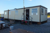
Letterkenny Airfield, Letterkenny, Ireland (EILT)

EILT
Letterkenny Airfield
Letterkenny, Ireland
Latest photos of Letterkenny Airfield, Letterkenny, Ireland
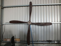
EILT, Large prop in one of the hangars at Limetree Airfield, Portarlington, Ireland, photo by Chris Hall
Chris Hall
EILT, Club house at Limetree Airfield, Portarlington, Ireland, photo by Chris Hall
Chris Hall
EILT, Limetree Airfield, Portarlington, Ireland, photo by Chris Hall
Chris Hall

Letterkenny Airfield (EILT) is a small airfield located in Letterkenny, Ireland. The airfield is situated at an elevation of 20 feet (6 meters) above sea level. Operations are conducted on 1 runway. The facility operates 1 published communication frequency. The gallery features 3 photos documenting air traffic and facilities at the airport.

Location & QuickFacts
Airport Codes
ICAO:EILTFAA:EILT
Location Letterkenny, Ireland
Airport Type Small Airport
Longitude/Latitude
54.951302, -7.672830
N 54° 57' 04.69" / W 7° 40' 22.19"
Elevation 20 feet (6 meters)
Scheduled Service No
Communications
Type Description Frequency
Air/Ground Letterkenny Traffic 129.550
Runway Information
Runway 08/26
Dimensions 1,969 x 0 ft (600 x 0 m)
Surface Grass
Lighted No
Status Open
08 26
Heading (True) ° °
Latitude 0.000000
N 0° 00' 00.00"
0.000000
N 0° 00' 00.00"
Longitude 0.000000
E 0° 00' 00.00"
0.000000
E 0° 00' 00.00"
Elevation 0 ft 0 ft
Displaced Threshold 0 ft 0 ft