Kirkenes Airport, Høybuktmoen, Kirkenes, Norway (ENKR / KKN)
Kirkenes Airport, Høybuktmoen
ENKR/KKN
Kirkenes Airport, Høybuktmoen
Kirkenes, Norway
Latest photos of Kirkenes Airport, Høybuktmoen, Kirkenes, Norway
Micha Lueck
Micha Lueck
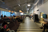
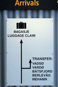
Kirkenes Airport, Høybuktmoen (ENKR/KKN) is a regional airport located in Kirkenes, Norway. The airfield is situated at an elevation of 283 feet (86 meters) above sea level. Operations are conducted on 1 runway. The facility operates 2 published communication frequencies. The gallery features 2 photos documenting air traffic and facilities at the airport.
Runway 05/23
| Dimensions | 6,939 x 148 ft (2115 x 45 m) |
| Surface | Asphalt |
| Lighted | Yes |
| Status | Open |
| 05 | 23 | |
| Heading (True) | 69° | 249° |
| Latitude |
69.722481 N 69° 43' 20.93" |
69.727608 N 69° 43' 39.39" |
| Longitude |
29.868345 E 29° 52' 06.04" |
29.906960 E 29° 54' 25.06" |
| Elevation | 281 ft | 280 ft |
| Displaced Threshold | 185 ft | 1450 ft |