Hanau Army Air Field, Erlensee, Germany (ETID)
Hanau Army Air Field
ETID
Hanau Army Air Field
Erlensee, Germany
Latest photo of Hanau Army Air Field, Erlensee, Germany
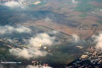
Michel Teiten ( www.mablehome.com )
Hanau Army Air Field (ETID) is a closed airfield located in Erlensee, Germany. The airfield is situated at an elevation of 368 feet (112 meters) above sea level. Operations are conducted on 1 runway. The facility operates 1 published communication frequency. The gallery features 1 photo documenting air traffic and facilities at the airport.
Runway 10/28
| Dimensions | 3,007 x 75 ft (917 x 23 m) |
| Surface | Asphalt |
| Lighted | Yes |
| Status | Open |
| 10 | 28 | |
| Heading (True) | 100° | 280° |
| Latitude |
50.169899 N 50° 10' 11.64" |
50.168499 N 50° 10' 06.60" |
| Longitude |
8.955270 E 8° 57' 18.97" |
8.967900 E 8° 58' 04.44" |
| Elevation | 363 ft | 368 ft |
| Displaced Threshold | 0 ft | 0 ft |