Amílcar Cabral International Airport, Espargos, Cape Verde (GVAC / SID)
Amílcar Cabral International Airport
GVAC/SID
Amílcar Cabral International Airport
Espargos, Cape Verde
Latest photos of Amílcar Cabral International Airport, Espargos, Cape Verde

Tomas Milosch
JPC
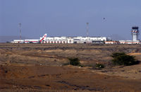
![GVAC, Terminal taken from outside the airport. (Sal) [Cape Verde]., photo by J.Louwen (PlaneCatcher at www.Jetphotos.net)](https://airport-data.com/images/airport/thumbnails/021/021346.jpg "GVAC, Terminal taken from outside the airport. (Sal) [Cape Verde]., photo by J.Louwen (PlaneCatcher at www.Jetphotos.net)")
J.Louwen (PlaneCatcher at www.Jetphotos.net)
![GVAC, Control Tower of GVAC (Sal) [Cape Verde]., photo by J.Louwen (PlaneCatcher at www.Jetphotos.net)](https://airport-data.com/images/airport/thumbnails/021/021345.jpg "GVAC, Control Tower of GVAC (Sal) [Cape Verde]., photo by J.Louwen (PlaneCatcher at www.Jetphotos.net)")
J.Louwen (PlaneCatcher at www.Jetphotos.net)
Amílcar Cabral International Airport (GVAC/SID) is a major international airport located in Espargos, Cape Verde. The airfield is situated at an elevation of 177 feet (54 meters) above sea level. Operations are conducted on 2 runways. The facility operates 4 published communication frequencies. The gallery features 6 photos documenting air traffic and facilities at the airport.
Runway 01/19
| Dimensions | 10,760 x 148 ft (3280 x 45 m) |
| Surface | Asphalt |
| Lighted | Yes |
| Status | Open |
| 01 | 19 | |
| Heading (True) | 358° | 178° |
| Latitude |
16.721548 N 16° 43' 17.57" |
16.751071 N 16° 45' 03.86" |
| Longitude |
-22.948846 W 22° 56' 55.85" |
-22.949051 W 22° 56' 56.58" |
| Elevation | 176 ft | 170 ft |
| Displaced Threshold | 0 ft | 872 ft |
Runway 07/25
| Dimensions | 4,921 x 148 ft (1500 x 45 m) |
| Surface | Asphalt |
| Lighted | No |
| Status | Closed |
| 07 | 25 | |
| Heading (True) | 58° | 238° |
| Latitude |
16.736700 N 16° 44' 12.12" |
16.743799 N 16° 44' 37.68" |
| Longitude |
-22.958000 W 22° 57' 28.80" |
-22.946199 W 22° 56' 46.32" |
| Elevation | 177 ft | 177 ft |
| Displaced Threshold | 0 ft | 0 ft |