Naples Municipal Airport (APF)
Naples Municipal Airport (APF)
APF
Naples Municipal Airport (APF)
Naples, FL
Latest photos of Naples Municipal Airport (APF)
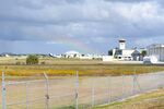
FerryPNL

FerryPNL
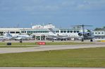
FerryPNL
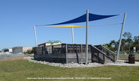
J.G. Handelman
| FAA Information Effective | 2026-07-09 |
| Airport Identifier | APF |
| Airport Status | Operational |
| Longitude/Latitude |
81°46'32.3011"
W /
26°9'8.7869"
N -81.775639 / 26.152441 (Estimated) |
| Elevation | 8.30 ft / 2.53 m (Surveyed) |
| Land | 732 acres |
| From nearest city | 2 nautical miles NE of Naples, FL |
| Location | Collier County, FL |
| Magnetic Variation | 03W (1995) |
| Airport Use | Open to public |
| Wind indicator | Yes |
| Segmented Circle | Yes |
| Control Tower | ATCT |
| Lighting Schedule | SEE RMK |
| Beacon Color | White-Green (lighted land airport) |
| Landing fee charge | No |
| Sectional chart | MIAMI |
| Region | ASO - Southern |
| Responsible ARTCC | ZMA - MIAMI |
| Tie-in FSS | MIA - MIAMI |
| FSS on Airport | No |
| FSS Toll Free | 1-800-WX-BRIEF |
| NOTAMs Facility | APF (NOTAM-d service available) |
| Certification type/date | 1983/01 |
Runway 05/23
| Dimensions | 6600 x 150 ft (2012 x 46 m) |
| Surface | ASPH (FAIR) |
| Surface treatment | Saw-cut or plastic Grooved |
| Edge lights | Medium |
| 05 | 23 | |
|---|---|---|
| Alignment | 44° | 224° |
| Physical elevation | 6.10 ft | 6.20 ft |
| Coordinates | 26.146211 / -81.782478 | 26.159221 / -81.768444 |
| Traffic pattern | Right | Left |
| Runway marking | Non-precision instrument , Good Condition | Non-precision instrument , Good Condition |
| VGSI | 4-light PAPI on right | 4-light PAPI on left |
| Runway end lights | Yes | Yes |
Runway 14/32
| Dimensions | 5001 x 100 ft (1524 x 30 m) |
| Surface | ASPH (GOOD) |
| Surface treatment | Saw-cut or plastic Grooved |
| Edge lights | Medium |
| 14 | 32 | |
|---|---|---|
| Alignment | 134° | 314° |
| Physical elevation | 6.20 ft | 6.90 ft |
| Coordinates | 26.157619 / -81.780254 | 26.148023 / -81.769330 |
| Traffic pattern | Right | Left |
| Runway marking | Non-precision instrument , Good Condition | Non-precision instrument , Good Condition |
| VGSI | 4-light PAPI on left | 4-light PAPI on left |
| Runway end lights | Yes | Yes |
Runway NE/SW
| Dimensions | 1850 x 100 ft (564 x 30 m) |
| Surface | TURF (GOOD) |
| Surface treatment |
| NE | SW | |
|---|---|---|
| Alignment | 44° | 224° |
| Physical elevation | 4.60 ft | 4.90 ft |
| Coordinates | 26.148609 / -81.780532 | 26.152256 / -81.776598 |
| Traffic pattern | Left | Left |
| Runway marking | Nonstandard , Good Condition | Nonstandard , Good Condition |
- EXTRMY NOISE SENSITIVE AREA; USE NOISE ABATEMENT PROCS.
- RUNUPS NA 2200 - 0700; TWY A RUNUP PADS FOR RWY 5/23 PISTON ACFT ONLY; JET ACFT RUNUP AREA TWY C BTW TWY C3 & TWY D PPR - ATCT .
- RWY 23 DSGND CALM WIND RWY FOR ARRS 2200-0600. RWY 5 DSGND CALM WIND RWY FOR DEPS 2200-0600.
- FULL SVC FUEL NOT AVBL DLY 0130-1030Z.
- APF GA APN CTN OBST LGT POLES.
- WX MOD ACFT NOTIFY OPS 24 HRS PRIOR TO ARR 239-564-1692
- CLSD TO ACFT EXCEEDING 75000 LBS MAX GWT DUAL GEAR INDCD ON ACFT OPRG CERT ISSUED BY MANUFACTURER.
- TWY C FM C-1 TO ER RWY 32 NOT VISIBLE FM ATCT.
- VOLUNTARY RESTRICTIONS EXIST FOR ALL ACFT OPS 2200-0700.
- FOR CD IF UNA TO CTC ON FSS FREQ, CTC FT MYERS APCH AT 239-416-1026, WHEN APCH CLSD CTC MIAMI ARTCC AT 305-716-1731.
- EXISTED PRIOR TO 1959.