Bridgeport/sikorsky Airport (BDR)
Bridgeport/sikorsky Airport (BDR)
BDR
Bridgeport/sikorsky Airport (BDR)
Bridgeport, CT
Latest photos of Bridgeport/sikorsky Airport (BDR)
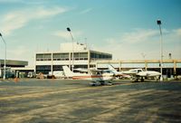
scotch-canadian
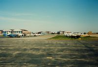
scotch-canadian
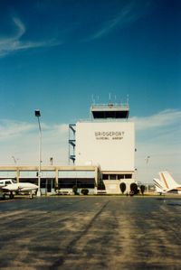
scotch-canadian
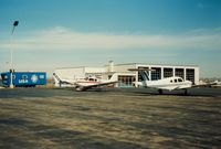
scotch-canadian
| FAA Information Effective | 2026-07-09 |
| Airport Identifier | BDR |
| Airport Status | Operational |
| Longitude/Latitude |
73°7'34.2330"
W /
41°9'48.5310"
N -73.126176 / 41.163481 (Estimated) |
| Elevation | 8.50 ft / 2.59 m (Surveyed) |
| Land | 800 acres |
| From nearest city | 3 nautical miles SE of Bridgeport, CT |
| Location | Fairfield County, CT |
| Magnetic Variation | 13W (1980) |
| Airport Use | Open to public |
| Wind indicator | Yes |
| Segmented Circle | Yes |
| Control Tower | ATCT |
| Lighting Schedule | SEE RMK |
| Beacon Color | White-Green (lighted land airport) |
| Landing fee charge | Yes |
| Sectional chart | NEW YORK |
| Region | ANE - New England |
| Responsible ARTCC | ZNY - NEW YORK |
| Tie-in FSS | BDR - BRIDGEPORT |
| FSS on Airport | No |
| FSS Toll Free | 1-800-WX-BRIEF |
| NOTAMs Facility | BDR (NOTAM-d service available) |
| Certification type/date | 2017/02 |
Runway 06/24
| Dimensions | 4677 x 100 ft (1426 x 30 m) |
| Surface | ASPH (EXCELLENT) |
| Surface treatment | Saw-cut or plastic Grooved |
| Edge lights | High |
| 06 | 24 | |
|---|---|---|
| Alignment | 45° | 225° |
| Physical elevation | 6.90 ft | 6.70 ft |
| Coordinates | 41.157041 / -73.131954 | 41.166119 / -73.119945 |
| Traffic pattern | Left | Left |
| Runway marking | Precision instrument , Good Condition | Non-precision instrument , Good Condition |
| ILS type | ILS/DME | |
| VGSI | 4-light PAPI on right | 4-light PAPI on left |
| Runway end lights | Yes | Yes |
Runway 11/29
| Dimensions | 4759 x 150 ft (1451 x 46 m) |
| Surface | ASPH (FAIR) |
| Surface treatment | |
| Edge lights | High |
| 11 | 29 | |
|---|---|---|
| Alignment | 98° | 278° |
| Physical elevation | 8.50 ft | 6.50 ft |
| Coordinates | 41.166239 / -73.134960 | 41.164458 / -73.117837 |
| Traffic pattern | Left | Right |
| Runway marking | Basic , Fair Condition | Non-precision instrument , Fair Condition |
| VGSI | 4-light PAPI on right | 4-light PAPI on left |
| Runway end lights | Yes | Yes |
- THERE MAY BE STANDING WATER ADJ TO ALL SFCS.
- AVOID OVERFLYING RESL AREAS NE & SE OF ARPT. DEPARTING RWY 24 AVOID TURNS TIL 1/2 MILE BYD SHORELINE.
- WHEN ATCT CLSD ALL ENG RUNUPS ARE PROHIBITED. HWVR, IF AN ACFT RQRS NIGHTTIME ENG MAINT, PPR FM AMGR IS RQRD AND RUNUPS ARE TO BE PERFORMED ON TWY G BTWN J & K. PILOTS ARE ADZD TO USE CARE PSNG THEIR ACFT TO PREVENT DMG FM PROP WASH TO AFLD SIGN.
- UNEVEN SFCS RWY 29 SAFETY AREA APCH END LEFT SIDE.
- POLE 120 FT .75 NM S OF ARPT UNLGTD.
- RWY 29 CLSD TO TKOF ACFT MORE THAN 45000 LB EXC 30 MIN PPR 203-576-7497.
- FOR CD WHEN ATCT CLSD CTC NEW YORK APCH AT 516-683-2449 OR 124.075
- EXTSV HOP BLW 10000 FT 5-15 MI NW THRU NE, FOR TFC INFO WHEN INVOF ARPT CTC SIKORSKY OPS ON 133.6/305.8 (0700-1630).
- WHEN WINDS ARE LESS THAN 5 KTS RQSTD USE OF RWY 11 OR 29.
- BIRDS & WILDLIFE FQTLY ON & INVOF ARPT.
- EXISTED PRIOR TO 1959.