Lakeland Linder International Airport (LAL)
Lakeland Linder International Airport (LAL)
LAL
Lakeland Linder International Airport (LAL)
Lakeland, FL
Latest photos of Lakeland Linder International Airport (LAL)
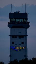
AviationLover50
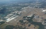
Mark Pasqualino
Peter Pasieka
Peter Pasieka
| FAA Information Effective | 2026-09-03 |
| Airport Identifier | LAL |
| Airport Status | Operational |
| Longitude/Latitude |
82°1'8.4000"
W /
27°59'15.5000"
N -82.019000 / 27.987639 (Estimated) |
| Elevation | 141.80 ft / 43.22 m (Surveyed) |
| Land | 1776 acres |
| From nearest city | 4 nautical miles SW of Lakeland, FL |
| Location | Polk County, FL |
| Magnetic Variation | 06W (2025) |
| Airport Use | Open to public |
| Wind indicator | Yes |
| Segmented Circle | Yes |
| Control Tower | ATCT |
| Lighting Schedule | SEE RMK |
| Beacon Color | White-Green (lighted land airport) |
| Landing fee charge | No |
| Sectional chart | MIAMI |
| Region | ASO - Southern |
| Responsible ARTCC | ZMA - MIAMI |
| Tie-in FSS | PIE - SAINT PETERSBURG |
| FSS on Airport | No |
| FSS Toll Free | 1-800-WX-BRIEF |
| NOTAMs Facility | LAL (NOTAM-d service available) |
| Certification type/date | 1977/12 |
Runway 05/23
| Dimensions | 5000 x 150 ft (1524 x 46 m) |
| Surface | ASPH (FAIR) |
| Surface treatment | Saw-cut or plastic Grooved |
| Edge lights | High |
| 05 | 23 | |
|---|---|---|
| Alignment | 45° | 225° |
| Physical elevation | 130.20 ft | 141.10 ft |
| Coordinates | 27.983451 / -82.020373 | 27.993200 / -82.009446 |
| Traffic pattern | Left | Left |
| Runway marking | Precision instrument , Good Condition | Non-precision instrument , Good Condition |
| VGSI | 4-light PAPI on left | 4-light PAPI on left |
Runway 08/26
| Dimensions | 2208 x 60 ft (673 x 18 m) |
| Surface | TURF (FAIR) |
| Surface treatment |
| 08 | 26 | |
|---|---|---|
| Alignment | 90° | 270° |
| Physical elevation | 127.50 ft | 131.10 ft |
| Coordinates | 27.979797 / -82.025087 | 27.979798 / -82.018248 |
| Traffic pattern | Left | Left |
| Runway marking | Nonstandard , Good Condition | None , Good Condition |
Runway 10/28
| Dimensions | 8500 x 150 ft (2591 x 46 m) |
| Surface | ASPH (EXCELLENT) |
| Surface treatment | Saw-cut or plastic Grooved |
| Edge lights | High |
| 10 | 28 | |
|---|---|---|
| Alignment | 90° | 270° |
| Physical elevation | 131.70 ft | 141.80 ft |
| Coordinates | 27.989237 / -82.033869 | 27.989294 / -82.007533 |
| Traffic pattern | Left | Left |
| Runway marking | Precision instrument , Good Condition | Non-precision instrument , Good Condition |
| ILS type | ILS/DME | |
| VGSI | 4-light PAPI on right | 4-light PAPI on left |
| RVR equipment | touchdown, midfield, rollout | touchdown, midfield, rollout |
| Approach light | ALSF2 | |
| CL lights | Yes | Yes |
| TDZ lights | Yes |
- BIRD ACT ON & INVOF ARPT.
- USCBP USER FEE ARPT; SVC THUR-MON, 1530-2400Z. FEE CHRGD OUTSIDE OF SVC HOURS. FEE PAYABLE ON SITE.
- 24 HR PPR OR IMT REPORTING UPON LDG FOR ACFT EQUIPPED WITH WEATHER MODIFICATION OR GEOENGINEERING EQPT CTC OPS 863-834-4911.
- TWY D, D1, & E1 UNLGTD.
- PJE WITHIN 5 NM 18000 BLW SR-SS
- INDEX C AVBL UPON REQ.