Capital Region International Airport (LAN)
Capital Region International Airport (LAN)
LAN
Capital Region International Airport (LAN)
Lansing, MI
Latest photos of Capital Region International Airport (LAN)
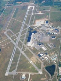
Bob Simmermon
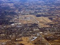
John Woody
| FAA Information Effective | 2026-09-03 |
| Airport Identifier | LAN |
| Airport Status | Operational |
| Longitude/Latitude |
84°35'10.3400"
W /
42°46'43.1310"
N -84.586206 / 42.778647 (Estimated) |
| Elevation | 860.50 ft / 262.28 m (Surveyed) |
| Land | 2160 acres |
| From nearest city | 3 nautical miles NW of Lansing, MI |
| Location | Clinton County, MI |
| Magnetic Variation | 05W (1985) |
| Airport Use | Open to public |
| Wind indicator | Yes |
| Segmented Circle | No |
| Control Tower | ATCT |
| Lighting Schedule | SS-SR |
| Beacon Color | White-Green (lighted land airport) |
| Landing fee charge | No |
| Sectional chart | DETROIT |
| Region | AGL - Great Lakes |
| Responsible ARTCC | ZOB - CLEVELAND |
| Tie-in FSS | LAN - LANSING |
| FSS on Airport | No |
| FSS Toll Free | 1-800-WX-BRIEF |
| NOTAMs Facility | LAN (NOTAM-d service available) |
| Certification type/date | 2005/11 |
Runway 06/24
| Dimensions | 5003 x 120 ft (1525 x 37 m) |
| Surface | ASPH (FAIR) |
| Surface treatment | Saw-cut or plastic Grooved |
| Edge lights | Medium |
| 06 | 24 | |
|---|---|---|
| Alignment | 53° | 233° |
| Physical elevation | 858.30 ft | 847.60 ft |
| Coordinates | 42.773167 / -84.601045 | 42.781423 / -84.586158 |
| Traffic pattern | Left | Left |
| Runway marking | Non-precision instrument , Fair Condition | Non-precision instrument , Fair Condition |
| VGSI | 4-light PAPI on left | 4-light PAPI on left |
| Runway end lights | Yes | Yes |
| CL lights | No | No |
| TDZ lights | No | No |
Runway 10L/28R
| Dimensions | 3601 x 75 ft (1098 x 23 m) |
| Surface | ASPH (FAIR) |
| Surface treatment | |
| PCN | 70 |
| 10L | 28R | |
|---|---|---|
| Alignment | 91° | 271° |
| Physical elevation | 845.50 ft | 850.20 ft |
| Coordinates | 42.781920 / -84.584975 | 42.781812 / -84.571563 |
| Traffic pattern | Left | Left |
| Runway marking | Basic , Good Condition | Basic , Good Condition |
| Runway end lights | No | No |
| CL lights | No | No |
| TDZ lights | No | No |
Runway 10R/28L
| Dimensions | 8506 x 150 ft (2593 x 46 m) |
| Surface | ASPH (FAIR) |
| Surface treatment | Saw-cut or plastic Grooved |
| Edge lights | High |
| 10R | 28L | |
|---|---|---|
| Alignment | 91° | 271° |
| Physical elevation | 860.20 ft | 848.00 ft |
| Coordinates | 42.778203 / -84.601054 | 42.777954 / -84.569375 |
| Traffic pattern | Left | Left |
| Runway marking | Precision instrument , Fair Condition | Precision instrument , Fair Condition |
| ILS type | ILS | ILS/DME |
| VGSI | 4-light PAPI on left | 4-light PAPI on right |
| RVR equipment | touchdown, rollout | touchdown, rollout |
| Approach light | MALSR | MALSR |
| Runway end lights | No | No |
| CL lights | No | No |
| TDZ lights | No | No |
- BIRDS ON & INVOF ARPT.
- TWY C SW OF TRANSIENT RAMP NOT AVBL TO ACFT WITH WINGSPAN 90 FT OR GTR.
- TWY G NOT AVBL TO ACFT WITH WINGSPAN 94 FT OR GREATER.
- RWY 06/24 SOUTH OF RWY 10R/28L AVBL TO ACR ACFT FOR TAXI ONLY.
- TWY E & L NOT AVBL TO ACR ACFT.
- RWY 10L/28R CLSD DLY SS-SR.
- WIDE BODY ACFT USE TWYS B OR B1 WHEN EXITING RWY 10R-28L. WIDE BODY ACFT SHOULD USE TWY D WHEN ACESNG THE TRML RAMP.
- PPR FOR ACFT WITH WINGSPAN GTR THAN 170 FT CTC ARPT OPS AT 517-321-8525.
- PAEW ADJ TO MOV AREAS FOR GRASS MOWING OPS APR-NOV.
- RWY 06/24 300 FT SAFETY AREA EACH END.
- INTL ARRIVALS ACCEPTED UP TO 200 PAX. PLEASE CTC CBP FIS AT 517-327-1052 FOR ADDNL INFO.
- USDOT EMERG CONTINGENCY PLAN ON FILE WITH THE ARPT OPS. PLEASE CTC OPS AT 517-321-8525 FOR ADDNL INFO.
- DTRMN PENDING.