Orlando International Airport (MCO)
Orlando International Airport (MCO)
MCO
Orlando International Airport (MCO)
Orlando, FL
Latest photos of Orlando International Airport (MCO)

Mark Pasqualino
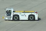
Mark Pasqualino
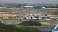
Florida Metal
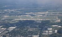
Florida Metal
| FAA Information Effective | 2026-07-09 |
| Airport Identifier | MCO |
| Airport Status | Operational |
| Longitude/Latitude |
81°18'32.4000"
W /
28°25'45.8000"
N -81.309000 / 28.429389 (Estimated) |
| Elevation | 96.40 ft / 29.38 m (Surveyed) |
| Land | 11605 acres |
| From nearest city | 6 nautical miles SE of Orlando, FL |
| Location | Orange County, FL |
| Magnetic Variation | 06W (2015) |
| Airport Use | Open to public |
| Wind indicator | Yes |
| Segmented Circle | No |
| Control Tower | ATCT |
| Lighting Schedule | SS-SR |
| Beacon Color | White-Green (lighted land airport) |
| Landing fee charge | No |
| Sectional chart | JACKSONVILLE |
| Region | ASO - Southern |
| Responsible ARTCC | ZJX - JACKSONVILLE |
| Tie-in FSS | PIE - SAINT PETERSBURG |
| FSS on Airport | No |
| FSS Toll Free | 1-800-WX-BRIEF |
| NOTAMs Facility | MCO (NOTAM-d service available) |
| Certification type/date | 1973/05 |
Runway 17L/35R
| Dimensions | 9001 x 150 ft (2744 x 46 m) |
| Surface | CONC (GOOD) |
| Surface treatment | Saw-cut or plastic Grooved |
| Edge lights | High |
| 17L | 35R | |
|---|---|---|
| Alignment | 179° | 359° |
| Physical elevation | 89.70 ft | 89.70 ft |
| Coordinates | 28.443697 / -81.282581 | 28.418944 / -81.282328 |
| Traffic pattern | Left | Left |
| Runway marking | Precision instrument , Good Condition | Precision instrument , Good Condition |
| ILS type | ILS/DME | ILS/DME |
| VGSI | 4-light PAPI on left | 4-light PAPI on right |
| RVR equipment | touchdown, midfield, rollout | touchdown, midfield, rollout |
| Approach light | ALSF2 | ALSF2 |
| CL lights | Yes | Yes |
| TDZ lights | Yes | Yes |
Runway 17R/35L
| Dimensions | 10000 x 150 ft (3048 x 46 m) |
| Surface | CONC (GOOD) |
| Surface treatment | Saw-cut or plastic Grooved |
| Edge lights | High |
| 17R | 35L | |
|---|---|---|
| Alignment | 179° | 359° |
| Physical elevation | 90.10 ft | 86.70 ft |
| Coordinates | 28.435612 / -81.295879 | 28.408110 / -81.295593 |
| Traffic pattern | Left | Left |
| Runway marking | Precision instrument , Good Condition | Precision instrument , Good Condition |
| ILS type | ILS/DME | ILS/DME |
| VGSI | 4-light PAPI on left | 4-light PAPI on right |
| RVR equipment | touchdown, midfield, rollout | touchdown, midfield, rollout |
| Approach light | ALSF2 | ALSF2 |
| CL lights | Yes | Yes |
| TDZ lights | Yes | Yes |
Runway 18L/36R
| Dimensions | 12005 x 200 ft (3659 x 61 m) |
| Surface | ASPH-CONC (GOOD) |
| Surface treatment | Saw-cut or plastic Grooved |
| Edge lights | High |
| 18L | 36R | |
|---|---|---|
| Alignment | 179° | 359° |
| Physical elevation | 92.40 ft | 91.00 ft |
| Coordinates | 28.448334 / -81.322306 | 28.415319 / -81.321954 |
| Traffic pattern | Left | Left |
| Runway marking | Precision instrument , Good Condition | Precision instrument , Good Condition |
| ILS type | ILS/DME | |
| VGSI | 4-light PAPI on left | 4-light PAPI on left |
| RVR equipment | touchdown, midfield, rollout | touchdown, midfield, rollout |
| Approach light | ALSF2 | |
| CL lights | Yes | Yes |
| TDZ lights | No | Yes |
Runway 18R/36L
| Dimensions | 12004 x 200 ft (3659 x 61 m) |
| Surface | ASPH-CONC (GOOD) |
| Surface treatment | Saw-cut or plastic Grooved |
| Edge lights | High |
| 18R | 36L | |
|---|---|---|
| Alignment | 179° | 359° |
| Physical elevation | 92.50 ft | 91.10 ft |
| Coordinates | 28.448294 / -81.326975 | 28.415280 / -81.326619 |
| Traffic pattern | Left | Left |
| Runway marking | Precision instrument , Good Condition | Precision instrument , Good Condition |
| ILS type | ILS/DME | ILS/DME |
| VGSI | 4-light PAPI on left | 4-light PAPI on left |
| RVR equipment | touchdown, midfield, rollout | touchdown, midfield, rollout |
| Approach light | MALSR | |
| Runway end lights | Yes | |
| CL lights | Yes | Yes |
| TDZ lights | Yes | No |
- BIRDS ON & INVOF ARPT.
- USE CAUTION IN VCNTY OF TWY "A" ALONG WEST RAMP.
- UNLESS ADV BY ATIS, DEP FLTS ON INITIAL CTC WITH GND CTL: ACFT ON WEST RAMP, AIRSIDE 1 & 3 (GATES 1-59) USE GND CTL 121.8. ACFT AT AIRSIDE 2 & 4 (GATES 60 AND HIGHER), USE GND CTL 126.4.
- TWY J3 AND TWY J4 RSTD TO WINGSPAN OF LESS THAN 118 FT.
- RUNWAY STATUS LIGHTS ARE IN OPERATION.
- ACFT WITH WINGSPAN GREATER THAN 214 FT MUST ADHERE TO SPECIFIC RY AND TAXI ROUTES. CONTACT AIRFIELD OPS AT 407-825-2036 FOR DETAILS.
- TWY A, SOUTH OF TWY A3 RSTD TO WINGSPAN OF LESS THAN 118 FT. PPR REQUIRED FOR WINGSPAN 118 FT OR GREATER.
- 24 HR PPR FOR ACFT EQUIPPED WITH WEATHER MODIFICATION OR GEOENGINEERING EQPT 407-825-2036.
- 24 HR PPR FOR ACFT EQUIPPED WITH WEATHER MODIFICATION OR GEOENGINEERING EQPT 407-825-2036.
- ALL AIRCRAFT DETERMINED TO BE FAA DESIGN GROUP IV AND ABOVE MUST PERFORM JUDGEMENTAL OVERSTEERING INSTEAD OF COCKPIT CNTRLN STEERING WHEN TAXIING.
- WHEN ORL ILS RY 7 AND MCO ILS RYS 17 & 18R SIMULTANEOUS OPERATIONS ARE CONDUCTED, ATC RADAR REQUIRED.
- BRIGHT LGTS ON ROAD BTN RY 17R/35L AND RY 17L/35R MAY BE MISTAKEN FOR RY LGTS.