Orlando Exec Airport (ORL)
Orlando Exec Airport (ORL)
ORL
Orlando Exec Airport (ORL)
Orlando, FL
Latest photos of Orlando Exec Airport (ORL)
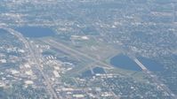
Florida Metal
Florida Metal
Florida Metal
Florida Metal
| FAA Information Effective | 2026-07-09 |
| Airport Identifier | ORL |
| Airport Status | Operational |
| Longitude/Latitude |
81°19'58.5480"
W /
28°32'43.6620"
N -81.332930 / 28.545462 (Estimated) |
| Elevation | 112.50 ft / 34.29 m (Surveyed) |
| Land | 967 acres |
| From nearest city | 3 nautical miles E of Orlando, FL |
| Location | Orange County, FL |
| Magnetic Variation | 06W (2015) |
| Airport Use | Open to public |
| Wind indicator | Yes |
| Segmented Circle | No |
| Control Tower | ATCT |
| Lighting Schedule | SEE RMK |
| Beacon Color | White-Green (lighted land airport) |
| Landing fee charge | No |
| Sectional chart | JACKSONVILLE |
| Region | ASO - Southern |
| Responsible ARTCC | ZJX - JACKSONVILLE |
| Tie-in FSS | PIE - SAINT PETERSBURG |
| FSS on Airport | No |
| FSS Toll Free | 1-800-WX-BRIEF |
| NOTAMs Facility | ORL (NOTAM-d service available) |
Runway 07/25
| Dimensions | 6004 x 150 ft (1830 x 46 m) |
| Surface | ASPH (FAIR) |
| Surface treatment | Saw-cut or plastic Grooved |
| Edge lights | High |
| PCN | 55 |
| 07 | 25 | |
|---|---|---|
| Alignment | 67° | 247° |
| Physical elevation | 105.60 ft | 109.70 ft |
| Coordinates | 28.542828 / -81.339274 | 28.549359 / -81.322098 |
| Traffic pattern | Left | Right |
| Runway marking | Precision instrument , Fair Condition | Precision instrument , Fair Condition |
| ILS type | ILS | ILS/DME |
| VGSI | 4-light PAPI on left | 4-light PAPI on right |
| RVR equipment | touchdown | rollout |
| Approach light | MALSR | |
| Runway end lights | Yes |
Runway 13/31
| Dimensions | 4625 x 100 ft (1410 x 30 m) |
| Surface | ASPH (FAIR) |
| Surface treatment | Saw-cut or plastic Grooved |
| Edge lights | High |
| PCN | 35 |
| 13 | 31 | |
|---|---|---|
| Alignment | 131° | 311° |
| Physical elevation | 104.00 ft | 109.00 ft |
| Coordinates | 28.548800 / -81.341291 | 28.540482 / -81.330395 |
| Traffic pattern | Left | Right |
| Runway marking | Basic , Fair Condition | Basic , Fair Condition |
| VGSI | 2-light PAPI on left | 2-light PAPI on left |
| Runway end lights | Yes | Yes |
- PPR FOR ACFT OVER 100000 LBS; CTC AMGR 407-825-1681.
- CBP OFC LCTD ONSITE PPR. CTC 407 825-5102. BE ALERT: CBP BOX LCTD ON EAST RAMP IS RSTRD.
- EXECUTIVE ARPT VFR ARR/DEP EXERCISE CAUTION DUE TO SMALL & HVY TURBO-JET ACFT TRANSITING ARPT TFC AREA 2000 FT & ABOVE ON APCH TO ORLANDO INTL 5.6 NM S.
- TWY E BTN TWY D & E5 IS NON MOVEMENT AREA.
- CALL BOXES MKD NEAR ENTRANCES TO W, N & E RAMPS.
- 24 HR ADVN NOTICE OR IMT REPORTING UPON LDG FOR ACFT EQUIPPED WITH WEATHER MODIFICATION OR GEOENGINEERING EQUIP CTC ARPT OPS407-579-5088
- LGTD BRIDGE HWY LCTD 0.5 NM S OF ARPT MAY GIVE FALSE INDCN OF APCH TO RWY 07 & 31.
- WILDLIFE INVOF ARPT.
- FOR CD OR TO CNL IFR WHEN ATCT IS CLSD, CTC ORLANDO APCH AT 407-852-7500.
- NOISE SENSITIVE ARPT. WHEN ATCT CLSD RWY 07 IS PREF NOISE ABATEMENT RWY WX PMTG. VOLUNTARY RESTRAINT FROM TGL OPS 2300 - 0700.
- BANNER TOWING OPS S RWY 07/25.
- ACFT TAXI ON S HALF OF THE W RAMP RESTR TO ADG1.
- ATC RADAR REQ WHEN ORL ILS RWY 7 & MCO ILS RWY 17 & 18R SIMULTANEOUS OPS ARE CONDUCTED.