Rapid City Regional Airport (RAP)
Rapid City Regional Airport (RAP)
RAP
Rapid City Regional Airport (RAP)
Rapid City, SD
Latest photos of Rapid City Regional Airport (RAP)
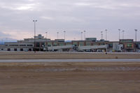
Micha Lueck
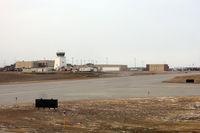
Micha Lueck
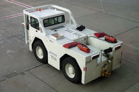
Micha Lueck
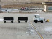
Micha Lueck
| FAA Information Effective | 2026-09-03 |
| Airport Identifier | RAP |
| Airport Status | Operational |
| Longitude/Latitude |
103°3'26.5000"
W /
44°2'43.2000"
N -103.057361 / 44.045333 (Estimated) |
| Elevation | 3203.50 ft / 976.43 m (Surveyed) |
| Land | 1655 acres |
| From nearest city | 8 nautical miles SE of Rapid City, SD |
| Location | Pennington County, SD |
| Magnetic Variation | 08E (2010) |
| Airport Use | Open to public |
| Wind indicator | Yes |
| Segmented Circle | Yes |
| Control Tower | ATCT |
| Lighting Schedule | SEE RMK |
| Beacon Color | White-Green (lighted land airport) |
| Landing fee charge | Yes |
| Sectional chart | CHEYENNE |
| Region | AGL - Great Lakes |
| Responsible ARTCC | ZDV - DENVER |
| Tie-in FSS | HON - HURON |
| FSS on Airport | No |
| FSS Toll Free | 1-800-WX-BRIEF |
| NOTAMs Facility | RAP (NOTAM-d service available) |
| Certification type/date | 1973/05 |
Runway 05/23
| Dimensions | 3601 x 75 ft (1098 x 23 m) |
| Surface | ASPH (GOOD) |
| Surface treatment | |
| Edge lights | Medium |
| 05 | 23 | |
|---|---|---|
| Alignment | 62° | 242° |
| Physical elevation | 3173.00 ft | 3203.50 ft |
| Coordinates | 44.047867 / -103.063821 | 44.052529 / -103.051749 |
| Traffic pattern | Right | Left |
| Runway marking | Non-precision instrument , Fair Condition | Non-precision instrument , Fair Condition |
| VGSI | 2-light PAPI on left | 2-light PAPI on left |
| Runway end lights | No | No |
| CL lights | No | No |
| TDZ lights | No | No |
Runway 14/32
| Dimensions | 8701 x 150 ft (2652 x 46 m) |
| Surface | CONC (GOOD) |
| Surface treatment | Saw-cut or plastic Grooved |
| Edge lights | High |
| 14 | 32 | |
|---|---|---|
| Alignment | 152° | 332° |
| Physical elevation | 3191.20 ft | 3142.80 ft |
| Coordinates | 44.053829 / -103.065007 | 44.032792 / -103.049389 |
| Traffic pattern | Left | Left |
| Runway marking | Precision instrument , Good Condition | Precision instrument , Good Condition |
| ILS type | ILS/DME | |
| VGSI | 4-light PAPI on left | 4-light PAPI on left |
| RVR equipment | rollout | touchdown |
| Approach light | MALSR | |
| Runway end lights | Yes | No |
| CL lights | No | No |
| TDZ lights | No | No |
- BIRDS ON & INVOF ARPT.
- TWR HAS LIMITED VISIBILITY OF TWY T1 AND TWY T2 AND TWY B AT AER RWY 23
- USE OF ARMY NATIONAL GUARD (ANG) RAMP IS OFFICIAL BUSINESS ONLY; FOR PPR CALL ANG FLIGHT OPS AT (605) 737-6128. NORMAL ANG OPS ARE TUES-FRI 1400-0030Z++ EXCEPT HOLIDAYS.
- OVERNIGHT PARKING ALLOWED IN DESIGNATED TIEDOWN AREAS ONLY.
- CTC GROUND FOR FREE TIE-DOWN LOCATIONS, OR CALL ARPT OPNS AT 605-593-3419.
- ALL CHARTER SERVICED ACFT OVER 12,500 LBS MUST CTC ARPT OPNS AT 605-593-3419 AT LEAST 48 HOURS PRIOR TO ARRIVAL.
- DIVERTING NON-BASED AIR CARRIERS CTC ARPT OPS AT (605) 593-3419 PRIOR TO DIVERTING DUE TO LIMITED GATE SPACE. NO CUSTOMS SERVICE AVBL.
- FOR CD IF UNA ON FREQ, CTC ATCT AT 605-646-6921. WHEN ATCT CLSD, CTC ELLSWORTH APCH AT 605-385-6198. WHEN APCH CLSD, CTC DENVER ARTCC AT 303-651-4257.
- RWY 5/23 NOT AVBL TO ACFT OVER 12500 LBS TO TAXI.
- HIGH VOL OF HELI TOURS INVOF MT RUSHMORE AND CRAZY HORSE MONUMENTS AT OR BLW 7500 FT; ALL OTR ACFT SHOULD RMN AT OR ABOVE 7700 FT AND MAINTAIN 1 NM HORIZONTAL SEPARATION FROM THE MONUMENTS; PILOTS ARE ADVISED TO MONITOR 122.85 FOR TFC ADVISORIES.
- BE ALERT: EXTENSIVE MILITARY JET TFC INVOF & NNW OF ARPT.
- LINE-OF-SIGHT IS RESTRICTED BETWEEN RY 14 & RY 23 PHYSICAL ENDS.
- 152 FT AGL TWR 2.5 NM NNW OF ARPT.
- BE ALERT DO NOT MISTAKE ELLSWORTH AFB, LOCATED 6.5 NM NNW FOR RAPID CITY RGNL.