Aitutaki Airport, Aitutaki, Cook Islands (NCAI / AIT)
Aitutaki Airport
NCAI/AIT
Aitutaki Airport
Aitutaki, Cook Islands
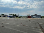
Latest photo of Aitutaki Airport, Aitutaki, Cook Islands
Timothy Aanerud
Aitutaki Airport (NCAI/AIT) is a small airfield located in Aitutaki, Cook Islands. The airfield is situated at an elevation of 14 feet (4 meters) above sea level. Operations are conducted on 2 runways. The facility operates 1 published communication frequency. The gallery features 1 photo documenting air traffic and facilities at the airport.
Runway 09/27
| Dimensions | 4,555 x 180 ft (1388 x 55 m) |
| Surface | Coral |
| Lighted | No |
| Status | Closed |
| 09 | 27 | |
| Heading (True) | 106° | 286° |
| Latitude |
-18.827499 S 18° 49' 39.00" |
-18.831100 S 18° 49' 51.96" |
| Longitude |
-159.776993 W 159° 46' 37.17" |
-159.763000 W 159° 45' 46.80" |
| Elevation | 7 ft | 13 ft |
| Displaced Threshold | 0 ft | 0 ft |
Runway 14/32
| Dimensions | 5,920 x 100 ft (1804 x 30 m) |
| Surface | Asphalt |
| Lighted | Yes |
| Status | Open |
| 14 | 32 | |
| Heading (True) | 154° | 334° |
| Latitude |
-18.830200 S 18° 49' 48.72" |
-18.844900 S 18° 50' 41.64" |
| Longitude |
-159.764999 W 159° 45' 54.00" |
-159.757004 W 159° 45' 25.21" |
| Elevation | 14 ft | 10 ft |
| Displaced Threshold | 0 ft | 0 ft |