Rarotonga International Airport, Avarua, Cook Islands (NCRG / RAR)
Rarotonga International Airport
NCRG/RAR
Rarotonga International Airport
Avarua, Cook Islands
Latest photos of Rarotonga International Airport, Avarua, Cook Islands
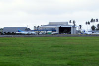
Micha Lueck
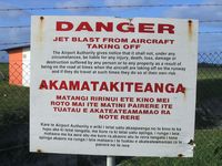
Micha Lueck
Rarotonga International Airport (NCRG/RAR) is a major international airport located in Avarua, Cook Islands. The airfield is situated at an elevation of 19 feet (6 meters) above sea level. Operations are conducted on 1 runway. The facility operates 3 published communication frequencies. The gallery features 2 photos documenting air traffic and facilities at the airport.
Runway 08/26
| Dimensions | 7,638 x 150 ft (2328 x 46 m) |
| Surface | Concrete |
| Lighted | Yes |
| Status | Open |
| 08 | 26 | |
| Heading (True) | 90° | 270° |
| Latitude |
-21.202700 S 21° 12' 09.72" |
-21.202700 S 21° 12' 09.72" |
| Longitude |
-159.817001 W 159° 49' 01.20" |
-159.794006 W 159° 47' 38.42" |
| Elevation | 21 ft | 14 ft |
| Displaced Threshold | 400 ft | 340 ft |