Presidente Itamar Franco Airport, Juiz de Fora, Brazil (SBZM / IZA)
Presidente Itamar Franco Airport
SBZM/IZA
Presidente Itamar Franco Airport
Juiz de Fora, Brazil
Latest photos of Presidente Itamar Franco Airport, Juiz de Fora, Brazil

Doug Robertson
Doug Robertson

Doug Robertson
Doug Robertson
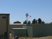
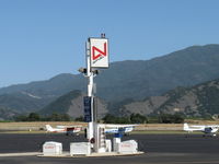
Presidente Itamar Franco Airport (SBZM/IZA) is a regional airport located in Juiz de Fora, Brazil. The airfield is situated at an elevation of 1348 feet (411 meters) above sea level. Operations are conducted on 2 runways. The facility operates 1 published communication frequency. The gallery features 9 photos documenting air traffic and facilities at the airport.
Runway 08/26
| Dimensions | 8,284 x 148 ft (2525 x 45 m) |
| Surface | Asphalt |
| Lighted | No |
| Status | Open |
| 08 | 26 | |
| Heading (True) | ° | ° |
| Latitude |
0.000000 N 0° 00' 00.00" |
0.000000 N 0° 00' 00.00" |
| Longitude |
0.000000 E 0° 00' 00.00" |
0.000000 E 0° 00' 00.00" |
| Elevation | 0 ft | 0 ft |
| Displaced Threshold | 0 ft | 0 ft |
Runway 8/26
| Dimensions | 8,284 x 148 ft (2525 x 45 m) |
| Surface | Asphalt |
| Lighted | Yes |
| Status | Open |
| 8 | 26 | |
| Heading (True) | ° | ° |
| Latitude |
0.000000 N 0° 00' 00.00" |
0.000000 N 0° 00' 00.00" |
| Longitude |
0.000000 E 0° 00' 00.00" |
0.000000 E 0° 00' 00.00" |
| Elevation | 0 ft | 0 ft |
| Displaced Threshold | 0 ft | 0 ft |