N898SK — 2007 Bombardier CRJ-900 (CL-600-2D24) Data
1
aircraft record found
N898SK
2007 Bombardier CRJ-900 (CL-600-2D24), c/n 15110
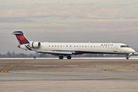
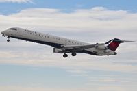
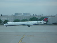
N898SK is a 2007 Bombardier CRJ-900 (CL-600-2D24) (serial number 15110). It is configured with 2 engines and 90 seats. Registration status is listed as Valid, with ownership recorded under SKYWEST AIRLINES INC in St George, UT, United States. The profile includes 4 photos documenting this aircraft.
Latest photos of N898SK

Mark Pasqualino
@ KMSP
Gerald Howard
@ KBOI
Gerald Howard
@ KBOI
Christian Maurer
@ IAH
Recent Routes
NO LIVE DATA
SkyWest
| Time | Callsign | FL | Speed | Heading | Route |
|---|---|---|---|---|---|
| 2026-11-20 01:10 UTC | SKW3854 / OO3854 | — | 124 kt | 209° |
GRB → DTW
GRB
→
DTW
Green Bay/austin Straubel International Airport → Detroit Metro Wayne County Airport |
| 2026-11-19 21:44 UTC | SKW4079 / OO4079 | FL266 | 116 kt | 209° | — |
| 2026-11-19 17:10 UTC | SKW3898 / OO3898 | FL5 | 127 kt | 209° |
MBS → DTW
MBS
→
DTW
Mbs International Airport → Detroit Metro Wayne County Airport |
| 2026-11-19 12:20 UTC | SKW3962 / OO3962 | — | 123 kt | 209° | — |
| 2026-11-19 02:54 UTC | SKW4173 / OO4173 | FL9 | 103 kt | 225° | — |
| 2026-11-18 20:44 UTC | SKW3792 / OO3792 | FL4 | 123 kt | 208° | — |
| 2026-11-18 16:26 UTC | SKW4009 / OO4009 | FL3 | 129 kt | 209° | — |
| 2026-11-16 23:32 UTC | SKW3888 / OO3888 | FL3 | 123 kt | 209° | — |
| 2026-11-16 19:10 UTC | SKW4110 / OO4110 | FL427 | 114 kt | 208° |
OMA → DTW
OMA
→
DTW
Eppley Airfield Airport → Detroit Metro Wayne County Airport |
| 2026-11-16 16:50 UTC | SKW4611 / OO4611 | FL10 | 116 kt | 145° | — |
| 2026-11-16 14:22 UTC | SKW3906 / OO3906 | FL3 | 135 kt | 209° |
GRB → DTW
GRB
→
DTW
Green Bay/austin Straubel International Airport → Detroit Metro Wayne County Airport |
| 2026-11-16 03:30 UTC | SKW3936 / OO3936 | — | 15 kt | 17° | — |
| 2026-11-15 23:50 UTC | SKW4167 / OO4167 | FL3 | 129 kt | 29° | — |
| 2026-11-15 22:12 UTC | SKW3964 / OO3964 | FL10 | 128 kt | 227° | — |
| 2026-11-14 13:36 UTC | SKW4313 / OO4313 | FL7 | 127 kt | 28° | — |
| 2026-11-14 05:32 UTC | SKW4297 / OO4297 | FL105 | 289 kt | 315° | — |
| 2026-11-13 16:48 UTC | SKW4338 / OO4338 | FL8 | 128 kt | 29° |
DTW → K8M8
DTW
→
K8M8
Detroit Metro Wayne County Airport → K8M8 |
| 2026-11-12 23:34 UTC | SKW3919 / OO3919 | FL9 | 123 kt | 29° | — |
| 2026-11-12 20:18 UTC | SKW3848 / OO3848 | FL10 | 128 kt | 28° | — |
| 2026-11-12 16:30 UTC | SKW3684 / OO3684 | FL10 | 132 kt | 29° | — |
| 2026-11-12 12:18 UTC | SKW3858 / OO3858 | FL10 | 130 kt | 30° |
6NY1 → DTW
6NY1
→
DTW
Old Port Royal Airport → Detroit Metro Wayne County Airport |
| 2026-11-12 03:58 UTC | SKW3949 / OO3949 | FL59 | 258 kt | 106° | — |
| 2026-11-12 01:48 UTC | SKW3843 / OO3843 | FL9 | 114 kt | 28° | — |
| 2026-11-11 21:46 UTC | SKW3847 / OO3847 | FL9 | 140 kt | 209° | — |
| 2026-11-11 18:04 UTC | SKW3976 / OO3976 | FL9 | 139 kt | 209° | — |
| 2026-11-11 14:12 UTC | SKW3837 / OO3837 | — | 28 kt | 118° |
SBN → DTW
SBN
→
DTW
South Bend International Airport → Detroit Metro Wayne County Airport |
| 2026-11-11 03:30 UTC | SKW3886 / OO3886 | FL15 | 136 kt | 269° | — |
| 2026-11-11 00:46 UTC | SKW3970 / OO3970 | — | 6 kt | 298° | — |
| 2026-11-10 20:02 UTC | SKW3989 / OO3989 | — | 4 kt | 214° | — |
| 2026-11-10 13:46 UTC | SKW3864 / OO3864 | — | 3 kt | 211° |
OMA → MSP
OMA
→
MSP
Eppley Airfield Airport → Minneapolis-st Paul Intl/wold-chamberlain Airport |
| 2026-11-10 01:16 UTC | SKW4024 / OO4024 | FL12 | 128 kt | 325° |
MSP → OMA
MSP
→
OMA
Minneapolis-st Paul Intl/wold-chamberlain Airport → Eppley Airfield Airport |
| 2026-11-09 23:06 UTC | SKW3753 / OO3753 | — | 1 kt | 211° | — |
| 2026-11-09 18:28 UTC | SKW3780 / OO3780 | — | 1 kt | 228° | — |
| 2026-11-09 12:20 UTC | SKW4158 / OO4158 | — | 1 kt | 203° | — |
| 2026-11-09 05:10 UTC | SKW4154 / OO4154 | FL163 | 314 kt | 296° | — |
| 2026-11-09 02:40 UTC | SKW4063 / OO4063 | — | 0 kt | 211° | — |
| 2026-11-08 20:14 UTC | SKW3971 / OO3971 | — | 0 kt | 219° |
MSP → K6V4
MSP
→
K6V4
Minneapolis-st Paul Intl/wold-chamberlain Airport → Wall Municipal Airport |
| 2026-11-08 13:18 UTC | SKW3931 / OO3931 | — | 3 kt | 228° | — |
| 2026-11-08 03:12 UTC | SKW3933 / OO3933 | FL9 | 116 kt | 206° |
MSP → ATW
MSP
→
ATW
Minneapolis-st Paul Intl/wold-chamberlain Airport → Appleton International Airport |
| 2026-11-08 00:52 UTC | SKW3810 / OO3810 | — | 0 kt | 231° | — |
| 2026-11-07 19:56 UTC | SKW3865 / OO3865 | — | 3 kt | 203° |
FSD → MSP
FSD
→
MSP
Joe Foss Fld Airport → Minneapolis-st Paul Intl/wold-chamberlain Airport |
| 2026-11-07 14:14 UTC | SKW3938 / OO3938 | — | 0 kt | 214° | — |
| 2026-11-07 03:36 UTC | SKW4040 / OO4040 | FL4 | 123 kt | 345° | — |
| 2026-11-06 23:04 UTC | SKW3787 / OO3787 | — | 6 kt | 301° |
STL → MSP
STL
→
MSP
St Louis Lambert International Airport → Minneapolis-st Paul Intl/wold-chamberlain Airport |
| 2026-11-06 18:10 UTC | SKW3752 / OO3752 | — | 1 kt | 233° | — |
| 2026-11-06 02:32 UTC | SKW3715 / OO3715 | FL10 | 121 kt | 1° | — |
| 2026-11-05 21:14 UTC | SKW3941 / OO3941 | FL10 | 127 kt | 208° | — |
| 2026-11-05 18:04 UTC | SKW4440 / OO4440 | FL10 | 119 kt | 209° |
ATW → DTW
ATW
→
DTW
Appleton International Airport → Detroit Metro Wayne County Airport |
| 2026-11-04 20:04 UTC | SKW3826 / OO3826 | FL10 | 129 kt | 209° | — |
| 2026-11-04 16:22 UTC | SKW3861 / OO3861 | FL9 | 132 kt | 209° |
MSP → ATW
MSP
→
ATW
Minneapolis-st Paul Intl/wold-chamberlain Airport → Appleton International Airport |
| 2026-11-03 13:52 UTC | SKW3977 / OO3977 | FL6 | 127 kt | 206° | — |
| 2026-11-03 01:46 UTC | SKW4013 / OO4013 | FL9 | 132 kt | 222° | — |
| 2026-11-02 23:40 UTC | SKW3889 / OO3889 | FL6 | 129 kt | 208° | — |
| 2026-11-02 13:54 UTC | SKW4176 / OO4176 | FL5 | 129 kt | 209° |
ATW → DTW
ATW
→
DTW
Appleton International Airport → Detroit Metro Wayne County Airport |
| 2026-11-02 02:52 UTC | SKW4159 / OO4159 | FL8 | 128 kt | 206° |
DTW → ATW
DTW
→
ATW
Detroit Metro Wayne County Airport → Appleton International Airport |
| 2026-11-02 00:48 UTC | SKW4166 / OO4166 | FL5 | 135 kt | 209° | — |
| 2026-11-01 11:44 UTC | SKW3884 / OO3884 | FL4 | 135 kt | 209° | — |
| 2026-11-01 00:46 UTC | SKW3885 / OO3885 | FL4 | 137 kt | 230° | — |
| 2026-10-31 22:48 UTC | SKW3999 / OO3999 | FL4 | 123 kt | 209° | — |
| 2026-10-31 18:48 UTC | SKW3957 / OO3957 | FL3 | 135 kt | 208° | — |
| 2026-10-30 15:22 UTC | SKW3784 / OO3784 | FL4 | 130 kt | 29° | — |
| 2026-10-29 16:24 UTC | SKW3986 / OO3986 | FL7 | 128 kt | 209° | — |
| 2026-10-28 22:38 UTC | SKW3860 / OO3860 | FL6 | 130 kt | 209° | — |
| 2026-10-28 18:14 UTC | SKW3869 / OO3869 | FL5 | 132 kt | 209° | — |
| 2026-10-28 13:54 UTC | SKW3841 / OO3841 | FL5 | 136 kt | 209° | — |
| 2026-10-28 10:16 UTC | SKW3980 / OO3980 | FL5 | 138 kt | 209° |
AZO → DTW
AZO
→
DTW
Kalamazoo/battle Creek International Airport → Detroit Metro Wayne County Airport |
| 2026-10-28 03:52 UTC | SKW3909 / OO3909 | FL7 | 119 kt | 171° | — |
| 2026-10-27 00:38 UTC | SKW3900 / OO3900 | FL20 | 157 kt | 270° | — |
| 2026-10-24 15:30 UTC | SKW4010 / OO4010 | FL3 | 136 kt | 208° | — |
| 2026-10-24 00:48 UTC | SKW3694 / OO3694 | FL4 | 138 kt | 208° | — |
| 2026-10-23 00:28 UTC | SKW3934 / OO3934 | FL5 | 144 kt | 29° | — |
| 2026-10-22 17:08 UTC | SKW4055 / OO4055 | FL5 | 132 kt | 29° | — |
| 2026-10-21 20:02 UTC | SKW4034 / OO4034 | FL5 | 132 kt | 29° | — |
Live location data from OpenSky Network
Airframe Info
| Manufacturer | Bombardier |
| Model | CRJ-900 (CL-600-2D24) Search all Bombardier CRJ-900 (CL-600-2D24) |
| Year built | 2007 |
| Construction Number (C/N) | 15110 |
| Aircraft Type | Fixed wing multi engine |
| Number of Seats | 90 |
| Number of Engines | 2 |
| Engine Type | Turbofan |
| Engine Manufacturer and Model | General Electric CF34-8C5A1 |
Aircraft
| Registration Number | N898SK |
| Mode S (ICAO24) Code | ac64a6 |
| Certification Class | Standard |
| Certification Issued | 2019-09-27 |
| Air Worthiness Test | 2013-05-30 |
| Last Action Taken | 2023-09-02 |
| Current Status | Valid |
Owner
| Registration Type | Corporation |
| Owner | SKYWEST AIRLINES INC |
| Address |
St George, UT 847902085 United States |
| Region | Northwest Mountain |