Lakeview Airport (30F)
Lakeview Airport (30F)
30F
Lakeview Airport (30F)
Lake Dallas, TX
Latest photos of Lakeview Airport (30F)
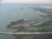
B. Pine
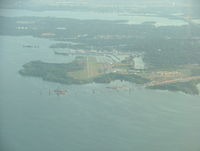
B.Pine
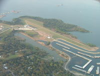
B.Pine
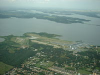
B.Pine
| FAA Information Effective | 2026-07-09 |
| Airport Identifier | 30F |
| Airport Status | Operational |
| Longitude/Latitude |
97°0'51.1000"
W /
33°7'53.0000"
N -97.014194 / 33.131389 (Estimated) |
| Elevation | 535.00 ft / 163.07 m (Estimated) |
| Land | 15 acres |
| From nearest city | 1 nautical miles NE of Lake Dallas, TX |
| Location | Denton County, TX |
| Magnetic Variation | 07E (1985) |
| Airport Use | Open to public |
| Wind indicator | Yes |
| Segmented Circle | No |
| Control Tower | NON-ATCT |
| Landing fee charge | No |
| Sectional chart | DALLAS-FT WORTH |
| Region | ASW - Southwest |
| Responsible ARTCC | ZFW - FORT WORTH |
| Tie-in FSS | FTW - FORT WORTH |
| FSS on Airport | No |
| FSS Toll Free | 1-800-WX-BRIEF |
| NOTAMs Facility | FTW (NOTAM-d service available) |
Runway 18L/36R
| Dimensions | 2600 x 75 ft (792 x 23 m) |
| Surface | TURF (FAIR) |
| Surface treatment |
| 18L | 36R | |
|---|---|---|
| Alignment | 184° | 4° |
| Physical elevation | 534.00 ft | 531.00 ft |
| Coordinates | 33.134945 / -97.013942 | 33.127811 / -97.014469 |
| Traffic pattern | Left | Left |
Runway 18R/36L
| Dimensions | 2815 x 30 ft (858 x 9 m) |
| Surface | ASPH (POOR) |
| Surface treatment |
| 18R | 36L | |
|---|---|---|
| Traffic pattern | Left | Left |
- NO TGL PERMITTED.
- RWY 18R/36L BOATS & TRAILERS PARKED ALONG WEST EDGE OF RWY.
- RWY 18R/36L DEFINED BY MOWING. UNA TO DTRM LCTN OF RWY, NOT INSPD.
- ARPT CLSD TO TSNT STUDENTS.
- BIRDS ON AND INVOF ARPT.
- POWERED PARACHUTES AND BALLOONS PROHIBITED.
- RWY 18L/36R LAKE 350 FT FM NORTH END OF RWY, 170 FT FM SOUTH END. PORTIONS OF RWY MAY BE UNDER WATER DURING HEAVY RAINS.
- GATE LOCKED 24 HRS.
- FOR CD CTC LONE STAR APCH AT 972-615-2799.
- RWY 36 30-50 FT TREES, 65 FT R, PARALLEL TO RWY.
- PRE-DATES THE ACT.