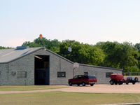
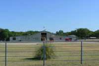
Cedar Circle Heliport (32XS)

32XS
Cedar Circle Heliport (32XS)
Midlothian, TX
Latest photos of Cedar Circle Heliport (32XS)
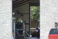
32XS, Cedar Circle Heliport, photo by Zane Adams
Zane Adams
32XS, Cedar Circle Heliport, photo by Zane Adams
Zane Adams
32XS, Cedar Circle Heliport, photo by Zane Adams
Zane Adams
Location & QuickFacts
FAA Information Effective 2013-12-12
Airport Identifier 32XS
Airport Status Operational
Longitude/Latitude 097-00-31.3200W/32-27-41.4200N
-97.008700/32.461506 (Estimated)
Elevation 750 ft / 228.60 m (Estimated)
Land 2 acres
From nearest city 2 nautical miles SW of Midlothian, TX
Location Ellis County, TX
Magnetic Variation 06E (1995)
Owner & Manager
Ownership Privately owned
Owner Dennis Lauterbach
Address 1161 Cedar Dr Po Box 985
Midlothian, TX 76065
Phone number 214-775-5364
Manager Dennis Lauterbach
Address 1161 Cedar Dr Po Box 985
Midlothian, TX 76065
Phone number 214-775-5364
Airport Operations and Facilities
Airport Use Private
Wind indicator Yes
Segmented Circle No
Control Tower No
Sectional chart Dallas-ft Worth
Region ASW - Southwest
Boundary ARTCC ZFW - Fort Worth
Tie-in FSS FTW - Fort Worth
FSS on Airport No
FSS Phone 817-541-3474
FSS Toll Free 1-800-WX-BRIEF
Runway Information
Runway H1
Dimensions 50 x 50 ft (15 x 15 m)
Surface CONC
H1
Traffic pattern Left Left