Sterling Airport (3B3)
Sterling Airport (3B3)
3B3
Sterling Airport (3B3)
Sterling, MA
Latest photo of Sterling Airport (3B3)
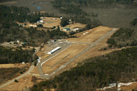
Bruce Vinal
| FAA Information Effective | 2026-09-03 |
| Airport Identifier | 3B3 |
| Airport Status | Operational |
| Longitude/Latitude |
71°47'34.2630"
W /
42°25'33.2490"
N -71.792851 / 42.425902 (Estimated) |
| Elevation | 459.00 ft / 139.90 m (Estimated) |
| Land | 100 acres |
| From nearest city | 2 nautical miles SW of Sterling, MA |
| Location | Worcester County, MA |
| Magnetic Variation | 15W (1985) |
| Airport Use | Open to public |
| Wind indicator | Yes |
| Segmented Circle | No |
| Control Tower | NON-ATCT |
| Lighting Schedule | SEE RMK |
| Beacon Color | White-Green (lighted land airport) |
| Landing fee charge | No |
| Sectional chart | NEW YORK |
| Region | ANE - New England |
| Responsible ARTCC | ZBW - BOSTON |
| Tie-in FSS | BDR - BRIDGEPORT |
| FSS on Airport | No |
| FSS Toll Free | 1-800-WX-BRIEF |
| NOTAMs Facility | BDR (NOTAM-d service available) |
Runway 16/34
| Dimensions | 3086 x 40 ft (941 x 12 m) |
| Surface | ASPH (GOOD) |
| Surface treatment | |
| Edge lights | Non-standard lighting system |
| 16 | 34 | |
|---|---|---|
| Physical elevation | 458.70 ft | 449.40 ft |
| Coordinates | 42.429127 / -71.796553 | 42.422678 / -71.789149 |
| Traffic pattern | Left | Left |
| Runway marking | Basic , Fair Condition | Basic , Fair Condition |
Runway H1
| Dimensions | 50 x 50 ft (15 x 15 m) |
| Surface | ASPH (FAIR) |
| Surface treatment |
| H1 | ||
|---|---|---|
| Physical elevation | 453.00 ft | ft |
| Coordinates | 42.426231 / -71.794775 | 0.000000 / 0.000000 |
| Traffic pattern | Left | Left |
| Runway marking | Basic |