Twelve Oaks Airport (5FL7)
Twelve Oaks Airport (5FL7)
5FL7
Twelve Oaks Airport (5FL7)
Hernando, FL
Latest photos of Twelve Oaks Airport (5FL7)
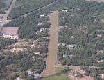
Mark Pasqualino

Mark Pasqualino
| FAA Information Effective | 2026-09-03 |
| Airport Identifier | 5FL7 |
| Airport Status | Operational |
| Longitude/Latitude |
82°21'49.3470"
W /
28°58'40.9240"
N -82.363708 / 28.978034 (Estimated) |
| Elevation | 50.00 ft / 15.24 m (Surveyed) |
| Land | 30 acres |
| From nearest city | 4 nautical miles NE of Hernando, FL |
| Location | Citrus County, FL |
| Magnetic Variation | 02W (1985) |
| Airport Use | Private |
| Wind indicator | Yes |
| Segmented Circle | Yes |
| Control Tower | NON-ATCT |
| Lighting Schedule | SS-SR |
| Landing fee charge | No |
| Sectional chart | JACKSONVILLE |
| Region | ASO - Southern |
| Responsible ARTCC | ZJX - JACKSONVILLE |
| Tie-in FSS | PIE - SAINT PETERSBURG |
| FSS on Airport | No |
| FSS Toll Free | 1-800-WX-BRIEF |
- FREQ - 122.9
- FOR CD CTC JACKSONVILLE APCH AT 904-741-0284.
- THE OPPOSITE END OF BOTH RWY IS NOT VSB FRM THE DEP END.
- PPR TO LND.
- THE AER 22 IS SUBJ FLOODING UNDER HVY RAIN CONDS MAKING THE FIRST 600 FT OF RWY 22 UNUSBL FOR TKOFS OR LDGS.
- E111: ESTAB & MAINT APROP SEGMENTED CRC TO INDICATE RIGHT TFC PTN RCMDD FOR RWY 22.