Hamp Airport (68R)
Hamp Airport (68R)
68R
Hamp Airport (68R)
Elwell, MI
Latest photo of Hamp Airport (68R)
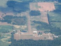
Bob Simmermon
| FAA Information Effective | 2026-07-09 |
| Airport Identifier | 68R |
| Airport Status | Operational |
| Longitude/Latitude |
84°48'4.4750"
W /
43°23'58.1500"
N -84.801243 / 43.399486 (Estimated) |
| Elevation | 825.00 ft / 251.46 m (Surveyed) |
| Land | 12 acres |
| From nearest city | 3 nautical miles W of Elwell, MI |
| Location | Gratiot County, MI |
| Magnetic Variation | 04W (1985) |
| Airport Use | Open to public |
| Wind indicator | Yes |
| Segmented Circle | No |
| Control Tower | NON-ATCT |
| Sectional chart | DETROIT |
| Region | AGL - Great Lakes |
| Responsible ARTCC | ZOB - CLEVELAND |
| Tie-in FSS | LAN - LANSING |
| FSS on Airport | No |
| FSS Toll Free | 1-800-WX-BRIEF |
| NOTAMs Facility | LAN (NOTAM-d service available) |
- TREES & BRUSH IN PRI SFC BOTH SIDES OF RWY.
- NO SNOW REMOVAL - CTC AMGR TO VFY FLD CONDS.
- DEER & LRG BIRDS ON & INVOF ARPT.
- FOR CD CTC GREAT LAKES APCH AT 269-459-3345, WHEN APCH CLSD CTC CLEVELAND ARTCC AT 440-774-0224/0490.
- PRVDD OBSTN IN RWY APCH SLP SFC BE REMOVED/LWRD OR THR DSPLCD, MKD, & LGTD FOR NGT OPS TO PRVD MNM 20:1 APCH SFC CLNC OVR OBSTNS; AREA 125 FT EITHER SIDE OF RCL & EXTDG TO A POINT 300 FT BYD RWY ENDS CLEAR OF OBSTN.