Middlebury State Airport (6B0)
Middlebury State Airport (6B0)
6B0
Middlebury State Airport (6B0)
Middlebury, VT
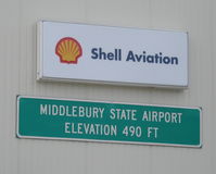
Latest photo of Middlebury State Airport (6B0)
Timothy Aanerud
| FAA Information Effective | 2026-09-03 |
| Airport Identifier | 6B0 |
| Airport Status | Operational |
| Longitude/Latitude |
73°5'43.9860"
W /
43°59'11.2990"
N -73.095552 / 43.986472 (Estimated) |
| Elevation | 494.10 ft / 150.60 m (Surveyed) |
| Land | 156 acres |
| From nearest city | 3 nautical miles SE of Middlebury, VT |
| Location | Addison County, VT |
| Magnetic Variation | 15W (1985) |
| Airport Use | Open to public |
| Wind indicator | Yes |
| Segmented Circle | Yes |
| Control Tower | NON-ATCT |
| Landing fee charge | No |
| Sectional chart | NEW YORK |
| Region | ANE - New England |
| Traffic Pattern Alt | 810 ft |
| Responsible ARTCC | ZBW - BOSTON |
| Tie-in FSS | BTV - BURLINGTON |
| FSS on Airport | No |
| FSS Toll Free | 1-800-WX-BRIEF |
| NOTAMs Facility | BTV (NOTAM-d service available) |
Runway 01/19
| Dimensions | 3206 x 60 ft (977 x 18 m) |
| Surface | ASPH (GOOD) |
| Surface treatment |
| 01 | 19 | |
|---|---|---|
| Alignment | 358° | 178° |
| Physical elevation | 484.80 ft | 484.80 ft |
| Coordinates | 43.982077 / -73.095319 | 43.990867 / -73.095784 |
| Traffic pattern | Left | Right |
| Runway marking | Non-precision instrument , Good Condition | Basic , Good Condition |
| Runway end lights | No | No |
| CL lights | No | No |
| TDZ lights | No | No |
- HIGH HILLS EAST OF ARPT.
- RWY CONDS MAY NOT BE MNT OR RPRTD WHEN THE ARPT IS UNATNDD.
- ULTRA-LIGHT & AGRICULTURAL ACFT ACTVTY ON & INVOF ARPT.
- NO LN OF SIGHT BTN RWY ENDS.
- PAJA ON WKENDS.
- FOR CD CTC BURLINGTON APCH AT 802-657-4413, WHEN APCH CLSD CTC BOSTON ARTCC AT 603-879-6859.
- EXISTED PRIOR TO 1959.