Boulder City Municipal Airport (BVU)
Boulder City Municipal Airport (BVU)
BVU
Boulder City Municipal Airport (BVU)
Boulder City, NV
Latest photos of Boulder City Municipal Airport (BVU)
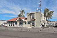
Jack Poelstra
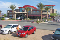
Terry Fletcher
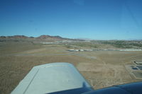
Nick Taylor Photography
| FAA Information Effective | 2026-09-03 |
| Airport Identifier | BVU |
| Airport Status | Operational |
| Longitude/Latitude |
114°51'39.9030"
W /
35°56'50.3090"
N -114.861084 / 35.947308 (Estimated) |
| Elevation | 2203.10 ft / 671.50 m (Surveyed) |
| Land | 530 acres |
| From nearest city | 1 nautical miles SW of Boulder City, NV |
| Location | Clark County, NV |
| Magnetic Variation | 11E (2020) |
| Airport Use | Open to public |
| Wind indicator | Yes |
| Segmented Circle | Yes |
| Control Tower | NON-ATCT |
| Lighting Schedule | SEE RMK |
| Beacon Color | White-Green (lighted land airport) |
| Landing fee charge | No |
| Sectional chart | LAS VEGAS |
| Region | AWP - Western-Pacific |
| Responsible ARTCC | ZLA - LOS ANGELES |
| Tie-in FSS | RNO - RENO |
| FSS on Airport | No |
| FSS Toll Free | 1-800-WX-BRIEF |
| NOTAMs Facility | RNO (NOTAM-d service available) |
Runway 09/27
| Dimensions | 5103 x 75 ft (1555 x 23 m) |
| Surface | ASPH (GOOD) |
| Surface treatment | |
| Edge lights | Medium |
| 09 | 27 | |
|---|---|---|
| Alignment | 100° | 280° |
| Physical elevation | 2108.40 ft | 2139.00 ft |
| Coordinates | 35.947460 / -114.869031 | 35.945092 / -114.852042 |
| Traffic pattern | Right | Left |
| Runway marking | Non-precision instrument , Good Condition | Non-precision instrument , Good Condition |
| VGSI | 2-light PAPI on left | 2-light PAPI on left |
| Runway end lights | Yes | Yes |
Runway 15/33
| Dimensions | 3852 x 75 ft (1174 x 23 m) |
| Surface | ASPH (GOOD) |
| Surface treatment | |
| Edge lights | Medium |
| 15 | 33 | |
|---|---|---|
| Physical elevation | 2203.10 ft | 2098.70 ft |
| Coordinates | 35.953793 / -114.863446 | 35.943558 / -114.860175 |
| Traffic pattern | Right | Left |
| Runway marking | Basic , Good Condition | Basic , Good Condition |
| VGSI | 2-light PAPI on left | |
| Runway end lights | Yes | Yes |
- RWY 33 STEEP RWY GRADIENT; RISING TERRAIN; OBSTACLES OFF DEP END OF RWY.
- LARGE NUMBER OF GRAND CANYON TOUR ACFT OPERATIONS IN VICINITY TRANSITING TO & FROM AIRPORT.
- HELICOPTERS CROSS ACTIVE RWYS AND TWYS.
- RWY 27 PREFERRED UNDER LIGHT OR NO WIND CONDITIONS.
- TAXIWAY SHOULDERS ADJ TO TWY D WEST OF RWY 15/33, SOFT GROUND AND DROPS OFF MORE THAN 3 INCHES.
- OPERATIONS IN SOUTHERN NEVADA - UNMANNED AIRCRAFT SYSTEM ACTIVITY WITHIN AN AREA DEFINED AS 3NM RADIUS OF BLD R-197/7NM, SFC-400 FT AGL.
- CTC AP OPS FOR RWY COND RPT, 702-293-9405, OR WHEN THE AP IS UNATNDD.
- AVOID OVERFLIGHT OF BOULDER CITY RESIDENTIAL AREAS.
- FOR ATC ASSISTANCE CALL OR CONTACT LAS VEGAS APCH AT 725-200-4432.
- RWY 15/33 NO RUNUP AREA. RUNUP AREA LCTD ON TWY D AND TWY A.
- LNDG FEE: FOR LNDG FEE SKED, CHECK ARPT WEBSITE OR CTC ARPT
- UNLIGHTED POWER LINES ALL QUADRANTS.
- UPHILL DEPARTURES ON RWY 33 NOT RECOMMENDED.
- STEEP RISING TERRAIN NORTH OF ARPT.
- ULTRALIGHT ACTIVITY 2 MILES SW OF ARPT INVOF DRY LAKE BED.
- SKYDIVE DROP ZONE ADJACENT AIRPORT NORTH EAST SIDE.