Brookville Air-park Airport (I62)
Brookville Air-park Airport (I62)
I62
Brookville Air-park Airport (I62)
Brookville, OH
Latest photos of Brookville Air-park Airport (I62)
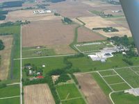
Bob Simmermon
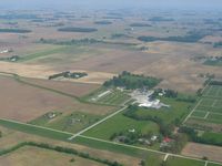
Bob Simmermon
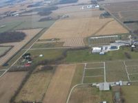
Bob Simmermon
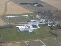
Bob Simmermon
| FAA Information Effective | 2013-12-12 |
| Airport Identifier | I62 |
| Airport Status | Operational |
| Longitude/Latitude |
084-25-59.8140W/39-51-45.1910N -84.433282/39.862553 (Estimated) |
| Elevation | 1037 ft / 316.08 m (Surveyed) |
| Land | 100 acres |
| From nearest city | 2 nautical miles NW of Brookville, OH |
| Location | Montgomery County, OH |
| Magnetic Variation | 04W (1985) |
| Airport Use | Open to public |
| Wind indicator | Yes |
| Segmented Circle | No |
| Control Tower | No |
| Lighting Schedule | SEE RMK |
| Landing fee charge | No |
| Sectional chart | Cincinnati |
| Region | AGL - Great Lakes |
| Boundary ARTCC | ZID - Indianapolis |
| Tie-in FSS | DAY - Dayton |
| FSS on Airport | No |
| FSS Toll Free | 1-800-WX-BRIEF |
| NOTAMs Facility | DAY (NOTAM-d service available) |