Riverside Airport (OH36)
Riverside Airport (OH36)
OH36
Riverside Airport (OH36)
Zanesville, OH
Latest photos of Riverside Airport (OH36)

Bob Simmermon
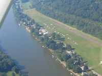
Bob Simmermon
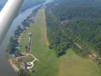
Bob Simmermon

Bob Simmermon
| FAA Information Effective | 2026-09-03 |
| Airport Identifier | OH36 |
| Airport Status | Operational |
| Longitude/Latitude |
81°59'1.4860"
W /
39°59'10.2430"
N -81.983746 / 39.986179 (Estimated) |
| Elevation | 700.00 ft / 213.36 m (Estimated) |
| Land | 54 acres |
| From nearest city | 1 nautical miles N of Zanesville, OH |
| Location | Muskingum County, OH |
| Magnetic Variation | 06W (1985) |
| Airport Use | Private |
| Wind indicator | Yes |
| Segmented Circle | No |
| Control Tower | NON-ATCT |
| Landing fee charge | No |
| Sectional chart | CINCINNATI |
| Region | AGL - Great Lakes |
| Responsible ARTCC | ZID - INDIANAPOLIS |
| Tie-in FSS | CLE - CLEVELAND |
| FSS on Airport | No |
| FSS Toll Free | 1-800-WX-BRIEF |