Brooks Fld Airport (RMY)
Brooks Fld Airport (RMY)
RMY
Brooks Fld Airport (RMY)
Marshall, MI
Latest photos of Brooks Fld Airport (RMY)
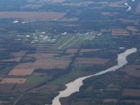
Bob Simmermon
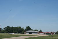
Mark Pasqualino
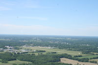
Mark Pasqualino
| FAA Information Effective | 2026-09-03 |
| Airport Identifier | RMY |
| Airport Status | Operational |
| Longitude/Latitude |
84°57'19.5995"
W /
42°15'4.2954"
N -84.955444 / 42.251193 (Estimated) |
| Elevation | 941.20 ft / 286.88 m (Surveyed) |
| Land | 170 acres |
| From nearest city | 1 nautical miles S of Marshall, MI |
| Location | Calhoun County, MI |
| Magnetic Variation | 05W (1995) |
| Airport Use | Open to public |
| Wind indicator | Yes |
| Segmented Circle | Yes |
| Control Tower | NON-ATCT |
| Lighting Schedule | SEE RMK |
| Beacon Color | White-Green (lighted land airport) |
| Landing fee charge | No |
| Sectional chart | DETROIT |
| Region | AGL - Great Lakes |
| Traffic Pattern Alt | 1000 ft |
| Responsible ARTCC | ZAU - CHICAGO |
| Tie-in FSS | LAN - LANSING |
| FSS on Airport | No |
| FSS Toll Free | 1-800-WX-BRIEF |
| NOTAMs Facility | RMY (NOTAM-d service available) |
Runway 10/28
| Dimensions | 3501 x 75 ft (1067 x 23 m) |
| Surface | ASPH (GOOD) |
| Surface treatment | |
| Edge lights | Medium |
| 10 | 28 | |
|---|---|---|
| Alignment | 97° | 277° |
| Physical elevation | 938.80 ft | 936.60 ft |
| Coordinates | 42.251747 / -84.961867 | 42.250639 / -84.949022 |
| Traffic pattern | Left | Left |
| Runway marking | Non-precision instrument , Good Condition | Non-precision instrument , Good Condition |
| VGSI | 4-light PAPI on left | 4-light PAPI on right |
| Runway end lights | No | |
| CL lights | No | No |
| TDZ lights | No | No |
Runway H1
| Dimensions | 100 x 100 ft (30 x 30 m) |
| Surface | CONC (GOOD) |
| Surface treatment | |
| Edge lights | Non-standard lighting system |
| H1 | ||
|---|---|---|
| Physical elevation | 940.00 ft | ft |
| Coordinates | 42.253206 / -84.961256 | 0.000000 / 0.000000 |
| Traffic pattern | Left | Left |
- DEER & LRG BIRDS ON & INVOF ARPT.
- 150 FT LGTD WATER TWR 3000 FT S OF HELIPAD.
- ADMIN BLDG ACES, PRESS 5-3-2-1.
- FOR CD CTC GREAT LAKES APCH AT 269-459-3344, WHEN APCH CLSD CTC CHICAGO ARTCC AT 630-906-8921.
- FOR SNOW REMOVAL HELIPAD H1 CALL AMGR.
- GLIDER & ULTRALIGHT ACTVTY ON & INVOF ARPT, SUMMER MOS.
- ULTRALIGHT ACFT FLY LEFT HAND PATTERN 500 FT AGL, S OF RY 10/28.