Rantoul Ntl Avn Cntr-frank Elliott Fld Airport (TIP)
Rantoul Ntl Avn Cntr-frank Elliott Fld Airport (TIP)
TIP
Rantoul Ntl Avn Cntr-frank Elliott Fld Airport (TIP)
Rantoul, IL
Latest photos of Rantoul Ntl Avn Cntr-frank Elliott Fld Airport (TIP)
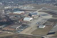
Mark Pasqualino
Mark Pasqualino
Mark Pasqualino
Mark Pasqualino
| FAA Information Effective | 2026-09-03 |
| Airport Identifier | TIP |
| Airport Status | Operational |
| Longitude/Latitude |
88°8'32.6000"
W /
40°17'36.8000"
N -88.142389 / 40.293556 (Estimated) |
| Elevation | 737.90 ft / 224.91 m (Surveyed) |
| Land | 1192 acres |
| Location | Champaign County, IL |
| Magnetic Variation | 01W (1995) |
| Airport Use | Open to public |
| Wind indicator | Yes |
| Segmented Circle | Yes |
| Control Tower | NON-ATCT |
| Lighting Schedule | SEE RMK |
| Beacon Color | White-Green (lighted land airport) |
| Landing fee charge | No |
| Sectional chart | CHICAGO |
| Region | AGL - Great Lakes |
| Responsible ARTCC | ZAU - CHICAGO |
| Tie-in FSS | STL - SAINT LOUIS |
| FSS Toll Free | 1-800-WX-BRIEF |
| NOTAMs Facility | TIP (NOTAM-d service available) |
Runway 09/27
| Dimensions | 5001 x 75 ft (1524 x 23 m) |
| Surface | ASPH (GOOD) |
| Surface treatment | |
| Edge lights | Medium |
| 09 | 27 | |
|---|---|---|
| Alignment | 90° | 270° |
| Physical elevation | 735.20 ft | 728.60 ft |
| Coordinates | 40.291976 / -88.149895 | 40.292073 / -88.131969 |
| Traffic pattern | Right | Left |
| Runway marking | Non-precision instrument , Fair Condition | Non-precision instrument , Fair Condition |
| VGSI | 4-light PAPI on left | 4-light PAPI on left |
| Runway end lights | Yes | Yes |
Runway 18/36
| Dimensions | 4894 x 75 ft (1492 x 23 m) |
| Surface | ASPH (GOOD) |
| Surface treatment | |
| Edge lights | Medium |
| 18 | 36 | |
|---|---|---|
| Alignment | 180° | 360° |
| Physical elevation | 737.40 ft | 733.30 ft |
| Coordinates | 40.301835 / -88.143861 | 40.288401 / -88.143853 |
| Traffic pattern | Left | Right |
| Runway marking | Non-precision instrument , Fair Condition | Non-precision instrument , Fair Condition |
- FBO OPNS MON-FRI 0700-1600. FBO SVC CLSD SAT+SUN UNLESS ADVN COORDINATION IS MADE.
- DEER & BIRDS ON AND INVOF ARPT. SEASONAL MOWING OPS ADJ TO RYS & TWYS.
- TWY 35 FT WIDE IN MOST PLACES. 48 HRS PPR FOR ACFT WITH SINGLE WHEEL LOAD GREATER THAN 15,000 LBS.
- FOR CD CTC CHAMPAIGN APCH AT 217-355-4071, WHEN APCH CLSD CTC CHICAGO ARTCC AT 630-906-8921