South Jersey Regional Airport (VAY)
South Jersey Regional Airport (VAY)
VAY
South Jersey Regional Airport (VAY)
Mount Holly, NJ
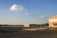
Latest photo of South Jersey Regional Airport (VAY)
Daniel L. Berek
| FAA Information Effective | 2026-09-03 |
| Airport Identifier | VAY |
| Airport Status | Operational |
| Longitude/Latitude |
74°50'44.7000"
W /
39°56'34.4000"
N -74.845750 / 39.942889 (Estimated) |
| Elevation | 52.80 ft / 16.09 m (Surveyed) |
| Land | 642 acres |
| From nearest city | 4 nautical miles SW of Mount Holly, NJ |
| Location | Burlington County, NJ |
| Magnetic Variation | 12W (2005) |
| Airport Use | Open to public |
| Wind indicator | Yes |
| Segmented Circle | Yes |
| Control Tower | NON-ATCT |
| Lighting Schedule | SEE RMK |
| Beacon Color | White-Green (lighted land airport) |
| Landing fee charge | No |
| Sectional chart | WASHINGTON |
| Region | AEA - Eastern |
| Traffic Pattern Alt | 800 ft |
| Responsible ARTCC | ZNY - NEW YORK |
| Tie-in FSS | MIV - MILLVILLE |
| FSS on Airport | No |
| FSS Toll Free | 1-800-WX-BRIEF |
| NOTAMs Facility | VAY (NOTAM-d service available) |
Runway 08/26
| Dimensions | 3881 x 50 ft (1183 x 15 m) |
| Surface | ASPH (GOOD) |
| Surface treatment | |
| Edge lights | Medium |
| 08 | 26 | |
|---|---|---|
| Alignment | 70° | 250° |
| Physical elevation | 43.80 ft | 51.80 ft |
| Coordinates | 39.941040 / -74.852250 | 39.944718 / -74.839259 |
| Traffic pattern | Left | Right |
| Runway marking | Non-precision instrument , Fair Condition | Non-precision instrument , Fair Condition |
| VGSI | 2-light PAPI on right | 2-light PAPI on right |
| Runway end lights | Yes | Yes |
| CL lights | No | No |
| TDZ lights | No | No |
- TREES ALONG SIDES OF RY PRIMARILY NW.
- BALLS MKG PLINES ON APH TO RY 08 FADED.
- DEER ON & INVOF ARPT.
- HELICOPTER TAKEOFFS AND LANDINGS RESTRICTED TO RY 08/26 ONLY.
- PARALLEL TAXIWAY NON-STANDARD WIDTH, 18 FT ASP.
- AVOID OVERFLYING HOUSING AREA WNW OF ARPT BELOW 300 FT WHEN IN THE TRAFFIC PATTERN FOR RWY 8.
- FOR CD CTC MC GUIRE APCH AT 609-754-2767.