X44
Miami C (X44)
Miami, FL
Latest photos of Miami C (X44)
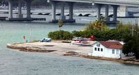
X44, A view of the famed Miami Seaplane Base in Miami, FL from the view on the Carnival Ecstasy., photo by Kreg Anderson
Kreg Anderson
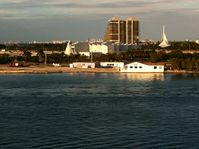
X44, Taken from the deck of a cruise ship., photo by Timothy Aanerud
Timothy Aanerud
Location & QuickFacts
FAA Information Effective 2026-07-09
Airport Identifier X44
Airport Status Operational
Longitude/Latitude 80°10'13.0000" W / 25°46'42.0000" N
-80.170278 / 25.778333 (Estimated)
Elevation 6.00 ft / 1.83 m (Estimated)
Land 2 acres
From nearest city 2 nautical miles E of Miami, FL
Location Dade County, FL
Magnetic Variation 03W (1985)
Owner & Manager
Ownership Publicly owned
Owner CITY OF MIAMI
Address 444 SW 2NE
MIAMI SEAPLANE BASE
MIAMI, FL 33130
Phone number 305-416-1025
Manager IGNACIO VEGA-PENICHET
Address 1000 MACARTHUR CAUSEWAY
444 SW 2ND AVE
MIAMI, FL 33132
Phone number 305-442-4444
Airport Operations and Facilities
Airport Use Open to public
Wind indicator Yes
Segmented Circle No
Control Tower NON-ATCT
Landing fee charge No
Sectional chart MIAMI
Region ASO - Southern
Responsible ARTCC ZMA - MIAMI
Tie-in FSS MIA - MIAMI
FSS on Airport No
FSS Toll Free 1-800-WX-BRIEF
NOTAMs Facility MIA (NOTAM-d service available)
Airport Communications
CTAF 123.025 MHz
UNICOM 122.8 MHz
Airport Services
Airframe repair NONE
Power plant repair NONE
Bottled oxygen NONE
Bulk oxygen NONE
Runway Information
Runway 12W/30W
Dimensions 14000 x 200 ft (4267 x 61 m)
Surface WATER
Surface treatment
12W 30W
Alignment 120° 300°
Coordinates 25.783072 / -80.179567 25.766492 / -80.141161
Traffic pattern Left Left
Remarks
  • 500 FT RDO TWR 3/4MI W OF BASE.
  • NUMEROUS WATERCRAFT AND LARGE PASSENGER VESSELS IN AREA.
  • FOR CD CTC MIAMI APCH AT 305-869-5432.
  • HELI PRKG ON SPB RAMP BY PPR ONLY.
  • USE CTN FOR HEL OPR AT WATSON ISLAND HELIPORT (89FA) ON ADJACENT PROPERTY TO SPB.
  • EXISTED PRIOR TO 1959.