Youngstown/warren Regional Airport (YNG)
Youngstown/warren Regional Airport (YNG)
YNG
Youngstown/warren Regional Airport (YNG)
Youngstown/warren, OH
Latest photos of Youngstown/warren Regional Airport (YNG)
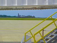
Murat Tanyel
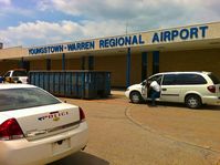
Murat Tanyel
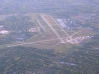
Bob Simmermon
| FAA Information Effective | 2026-09-03 |
| Airport Identifier | YNG |
| Airport Status | Operational |
| Longitude/Latitude |
80°40'49.3190"
W /
41°15'41.7230"
N -80.680366 / 41.261590 (Estimated) |
| Elevation | 1191.50 ft / 363.17 m (Surveyed) |
| Land | 1468 acres |
| From nearest city | 10 nautical miles N of Youngstown/warren, OH |
| Location | Trumbull County, OH |
| Magnetic Variation | 08W (1990) |
| Airport Use | Open to public |
| Wind indicator | Yes |
| Segmented Circle | No |
| Control Tower | ATCT-TRACON |
| Beacon Color | White-Green (lighted land airport) |
| Landing fee charge | Yes |
| Sectional chart | DETROIT |
| Region | AGL - Great Lakes |
| Responsible ARTCC | ZOB - CLEVELAND |
| Tie-in FSS | CLE - CLEVELAND |
| FSS on Airport | No |
| FSS Toll Free | 1-800-WX-BRIEF |
| NOTAMs Facility | YNG (NOTAM-d service available) |
| Certification type/date | 1973/05 |
Runway 05/23
| Dimensions | 5002 x 150 ft (1525 x 46 m) |
| Surface | ASPH (GOOD) |
| Surface treatment | Saw-cut or plastic Grooved |
| Edge lights | Medium |
| 05 | 23 | |
|---|---|---|
| Alignment | 45° | 225° |
| Physical elevation | 1123.00 ft | 1191.50 ft |
| Coordinates | 41.249721 / -80.682484 | 41.259435 / -80.669631 |
| Traffic pattern | Left | Left |
| Runway marking | Non-precision instrument , Good Condition | Non-precision instrument , Good Condition |
| VGSI | 4-light PAPI on right |
4-light PAPI on right *PAPI UNUSBL BYD 8 DEGS LEFT OF CNTRLN. |
| Runway end lights | No | No |
Runway 14/32
| Dimensions | 9003 x 150 ft (2744 x 46 m) |
| Surface | ASPH (GOOD) |
| Surface treatment | Saw-cut or plastic Grooved |
| Edge lights | High |
| 14 | 32 | |
|---|---|---|
| Alignment | 135° | 315° |
| Physical elevation | 1107.10 ft | 1185.80 ft |
| Coordinates | 41.272881 / -80.692347 | 41.255423 / -80.669177 |
| Traffic pattern | Left | Left |
| Runway marking | Precision instrument , Good Condition | Precision instrument , Good Condition |
| ILS type | ILS | ILS |
| VGSI | 4-light PAPI on left |
4-light PAPI on left *PAPI UNUSBL BYD 8 DEGS RIGHT OF CNTRLN. |
| RVR equipment | rollout | touchdown |
| Approach light | MALSR | MALSR |
Runway 143/323
| Dimensions | 3501 x 60 ft (1067 x 18 m) |
| Surface | ASPH (FAIR) |
| Surface treatment |
| 143 | 323 | |
|---|---|---|
| Alignment | 135° | 315° |
| Physical elevation | 1104.10 ft | 1151.50 ft |
| Coordinates | 41.268411 / -80.690013 | 41.261623 / -80.681005 |
| Traffic pattern | Left | Left |
- RSTD: MIL LANDING ZONE 143*-323* FOR MIL USE ONLY. NO PRACTICE APCH 0300-1300Z++. AFRC ACFT OPR RSTD DUR BIRD WATCH CON MODERATE (TKOF OR LDG PERMS ONLY WHEN DEP AND ARR RTE AVOID IDENT BIRD ACT, NO LCL IFR/VFR TFC PAT ACT) AND SEVERE (TKOF AND LDG PROH WO OG/CC APVL).
- MISC: FBO LINE SVC AVBL 0400-1100Z, OT FONE C330-442-3374.
- MILITARY: AFRC: PPR FOR RAMP AND MIL LZ CTC BASOPS 1230-0400Z++ MON-FRI EXC HOLS (DT 1130-0400Z) AND DURG UNIT TRNG SAT 1300-2200Z++ AND SUN 1200-2100Z++. 48 HRS PN FOR RAMP CTC AFLD MGMT DSN 346-1069/1181, C330-609-1069/1181. AFLD MGMT AND MIL LZ 143/323 OPEN 1230-0400Z++ MON-THU & 1230-0001Z++ FRI, EXC HOLS; 1200-2100Z++ SAT & SUN DURG UNIT TRNG.
- AFRC: NO TRANS ALERT SVC. INBD MIL ACFT INDICATE IN RMK DD FORM 175 WHETHER PRK WILL BE ON CIV OR MIL RAMP. TRANS ACFT RQR MAINT WILL BE RECOVERED BY HOME BASE. ACFT SECURITY NOT AVBL FOR C5 RON EXC EMERG.
- AFRC: MIL LANDING ZONE 323 1.4% DOWNSLOPE. RY 143 1.4% UPSLOPE. SEE FLIP AP/1 SUPPLEMENTARY ARPT RMK.
- FUEL: J8+100(MIL) J8(PN REQ) (NC-100LL,A).
- FLUID: LOX (MIL).
- OIL: O -156
- TERMINAL RAMP AND GENERAL AVIATION PARKING NOT VIS FR THE NW PORTION OF TWY H. MILITARY RAMP FOR MILITARY USE ONLY.
- COMMERCIAL RAMP CLSD TO ALL GA TRAFFIC, COMMERCIAL BOUNDARY AREA DEFINED BY RED SFC PAINTED MARKING.
- AMOPS DOES NOT ISSUE OR STOR COMSEC. LTD COMSEC STOR AVBL AT COMD POST, CTC DSN 346-1315, C330-609-1315 FOR PRIOR COORD.
- FOR CD CTC YOUNGSTOWN APCH AT 330-856-4806, WHEN APCH CLSD CTC CLEVELAND ARTCC AT 440-774-0232/0490.
- AFRC: AIRCREWS - US CSTMS SVC NOT IMMED AVBL. ALL SUPPORT FOR CSTMS MUST BE PRE-COORD AT LEAST 72 HR IN ADVANCE WITH AFLD MGMT
- TWY J ACFT TURN RADIUS RESTRICTION EXISTS FOR ACFT HAVING NOSE GEAR TO MAIN GEAR DIST GREATER THAN 64FT AND MAIN GEAR WID GREATER THAN 30FT
- RSTD: ALL MIL ACFT OPR RSTD DRG BIRD WATCH CONDS, MODERATE (TKOF AND LNDG PMTD ONLY WHEN DEP/ARR RTE AVOID IDENT BIRD ACT, NON LCL IFR/VFR PAT ACT) AND SEVERE (TKOF AND LNDG PROHIBITED WO OG/CC APVL).
- CTN: MIL CONDUCTING NGT VISION DEVICE OPS MON-THU DUSK-0400++.
- MISC: ARFF OPRS IN A RDCD LVL OF SVC STS RGLRLY. CTC FIRE DEPT (DSN 346-1105 OR C330-609-1295) PRIOR TO ARR TO DTRM RISK FACTORS FOR TYPE ACFT.
- DEER & BIRD HAZARD. ALL MIL ACFT CTC VADER OPS FOR BIRD WATCH COND.